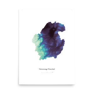
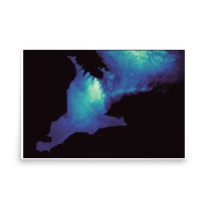
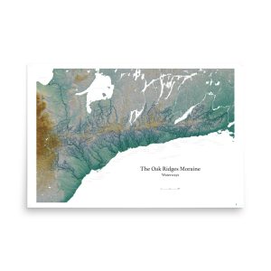
Getting To Know Us: The benefits of smarter planning

This is a part one of three posts outlining our “two sides of the coin” approach to advocacy, or our focus on achieving what is known as “co-benefits”.

In this post, we focus on the first side of the coin, which is planning our communities in a way that is more efficient and that enhances the quality of life for residents.

Introduction

Defining "Environment" in a Comprehensive Sense

Spend just a little while with us, and you’ll quickly understand that when we say “environment”, we mean it in the classical sense, which is, “the area in which something exists or lives”. In other words, it includes the areas of our homes, our neighbourhoods, and our cities, as well as those areas more commonly associated with “the environment”, such as the wilderness or the global commons.

Maximizing Co-Benefits for Communities

In this post, the first of three that are planned in this series, we cover why planning our communities in a way that maximizes what are known as co-benefits makes a lot of sense, including by reducing the burden on the taxpayer and increasing quality of life and enjoyment.

Part two, which focuses on environmental benefits, and part three, which ties parts one and two together, as well as provides more specific information on our efforts, are in the pipeline, so keep an eye out!

The Greenbelt and Municipal Planning

Understanding the Greenbelt's Role in Ontario's Planning Regime

As an organization that focuses primarily on issues surrounding the Greenbelt, you might be a bit surprised by our focus on municipal planning and urban areas. The Greenbelt is a crown jewel on Ontario’s planning regime, and it helps to both direct development toward areas where it’s most beneficial, by, in large part, restricting sprawl, this, in turn, helps protect the valuable natural assets, such as farmland, fresh water, and clean air, that enable our high quality of life.

We think it is important to view the Greenbelt in this context, as a policy that serves as the foundation stone of Ontario’s prosperous and sustainable future. The Greenbelt, in other words, is a valuable tool that our Province has to shape land-use in a way that improves our cities, towns, agricultural areas, and natural habitat.

It’s crucial to underline, accordingly, the fact that, as a tool, the Greenbelt can be further implemented – enhanced and expanded – for the benefit of all Ontarians.

Impact on Municipal Budgets

Land-use and climate action! What could be more exciting than that!?

But seriously, land-use is a pretty dry topic on the surface – zoning, development applications, approval processes and appeals… (although the right of citizens to appeal has been severely curtailed in Ontario of later by the Ford government).

For evidence of how dry this stuff is, one need look no further than council meetings, where the vast majority of attendees are suits, representatives of developers. The reason they are there is pretty obvious – they stand to make money if they are able to get a decision going their way.

The Approvals Process, and Citizen Engagement

For citizens, on the other hand, attending these meetings is taking time from family or other social obligations – and it’s time they aren’t paid for, or, for the most part, time that would result in financial benefit to them.

Thus, the decks tend to be stacked at these meetings.

Councils, elected by the public, generally do their best to ensure decisions aren’t outrageously at odds with the public’s interest. But, councillors are often overworked and under-resourced, and need to rely on information given to them by city staff (also often overworked and under-resourced). In this scenario, it isn’t difficult to see the opportunity for developers to step into the gap and provide information and resources that buttress their claims.

For us at SCGC, a lot of our focus is on these processes because they determine where houses get built, and conversely where houses don’t get built (which happens to be where farmland and natural habitat is preserved!).

To be clear, building houses in not the issue – it’s where they are built that is typically the problem.

Below we briefly sketch out the first of these components.

Challenges and Solutions

Infrastructure Problems, a Growing Threat

Our suburban style of living, while there are a lot of nice things about it, is putting a huge hole in municipal budgets.

The roads that we use to get to and from work, to drop our kids off at school, to purchase groceries and to visit the mall, all cost a lot to maintain.

In 2021 the Financial Accountability Office of Ontario (FAO) released a report that puts the municipal infrastructure deficit at more than $50 billion. This is how much it would cost to bring roads, bridges, and other municipal infrastructure to a state of good repair.

Spread out infrastructure is less efficient and more expensive to maintain. The cost is likely to only increase as climate change results in more extreme weather, placing additional stress on it. (The FAO did a report on this, too.)

Why Sprawl Is So Attractive

One of the biggest bang-for-buck transformations that a municipality can do is convert farmland into urban development. This goes for developers, too, which is why many of them love to build sprawl.

The purchase price of farmland is low, relative to a similar size of land with existing infrastructure and development. When this land is brought into the urban envelope, its value increases dramatically.

(Witness the recent Greenbelt scandal, where plots of land value at $240 million prior to being given permission to build skyrocketed to a value of $8.523 billion once lands were removed from protections.)

This, of course, is extremely profitable for developers, and municipalities can, for a period of time, also feel like they have come out ahead. The newly added tax base contributes much needed revenue, which can be used to address those infrastructure needs outlined above.

The Economic Drag that Sprawl Creates Over Time

But, over the course of several years, that spread-out infrastructure in the newly developed area, along with pre-existing spread-out infrastructure, starts to act as a drag on municipal coffers, and ultimately creates a net-negative revenue flow – more goes out to maintain it than comes in from the tax base it services. (By some estimates, municipalities receive just 10 – 20% of revenue vs liability over the lifetime of these developments. Any business run this way would have been bankrupted long ago, and yet that’s what we demand of our elected leaders.)

Factoring in the costs of pollution associated with needing a car to access amenities, like groceries, not to mention the contribution to climate change those cars make, and those costs only grow.

This is why experts in the area have taken to calling sprawl a “Ponzi scheme” and “Ontario’s tar sands“.

A recent study by the City of Ottawa found that, every year, it cost $465 per capita to service residents in low density areas, while it took in $606 more per capita than it spent from those living in high density areas.

Sprawl is an expensive, and inherently inequitable form of development. Those living in suburban sprawl areas don’t pay the full cost for the infrastructure servicing them, with those living in more dense parts of the jurisdiction, which often tend to be those who are also less well off, subsidizing their cost.

Click the image for a larger version.

Sustaining Sprawl at the Cost of Other Services

When our local governments are constantly needing to increase revenue simply to maintain what we’ve already got, it puts a huge amount of pressure on other services, including many that we place high value on.

These services include cultural activities, funding for public transportation, for affordable housing and mental health, parks, libraries, schools and emergency services all have to compete for a slice of the funding pie, and many are limited due to the pressure on budgets that municipalities face, in no small part thanks to unsustainable patterns of urban development.

Even more pressure is added to the mix when costs associated with a rapidly changing climate are factored in.

As severe and unpredictable weather events ramp up, investments need to be made to ensure infrastructure, such as storm water systems, are able to cope. What were considered “100-year storms” just a decade ago are now likely to happen on an almost yearly basis, and the rare events – those 100-year storms – will be even wilder.

Moving Forward

Promoting Walkability and Mixed-Use Development

Over the past few decades, there has been a growth in the number of planners interested in how the way that we build our communities can improve quality of life for residents, enhance economic vitality, as well as promote a healthy environment. Much of the impetus behind this emergent practice is in response to the negative impacts that car centred planning, such as sprawl, has had on the livability of the places we call home.

Practices like promoting walkability in neighbourhoods, ensuring there is a range of housing choices and a mix of building types, with proximity between residential and commercial areas, accessible schools and other services, such as transit, as well as green-spaces such as parks and playgrounds, are some of what advocates of this form of planning promote.

Well-known planners in this area include Brent Toderian, former Chief Planner for the City of Vancouver, Jennifer Keesmaat, former Chief Planner for the City of Toronto, as well as Charles Marohn, of Strong Towns, to name a few.

And, while more conventional approaches to urban planning remain dominant, these ideas have filtered through. Concepts like complete streets, transit oriented design, along with a growing awareness of the risks of and vulnerabilities to climate change impacts, are increasingly present in high-level policy and planning documents.

(Until it was effectively scrapped by the Ford government, the Growth Plan placed a premium on complete communities, reflecting many of the principles outlined above.)

Photo of John St., Toronto, showing a street with many people walking on it, as well as people sitting on chairs at tables on the street. The widewalk has been extended to enhance walkability. Credit City of Toronto.

This image, taken from the City of Toronto’s website outlining their efforts to create more complete streets, illustrates how many municipalities are trying to reinvigorate streetscapes and enhance the experiences of the residents who live around them.

Credit: City of Toronto

Conclusion

We can build our communities in a way that improves our quality of life, that supports a thriving economy, and that promotes a healthy environment. Cities like Toronto, Calgary, Vancouver, and Montreal are implementing projects in-line with many of the goals outlined above.

By enhancing the livability of our urban areas, including with increased public transit and active transportation like walking, we mitigate negative impacts like carbon emissions and health risks associated with sedentary lifestyles. These are some of the co-benefits of better planning.

In our next post in this series, we look more closely at how poor planning impacts the environment.

-/-

This work by Simcoe County Greenbelt Coalition is licensed under CC BY-NC 4.0

Share This

Sharing builds awareness and helps achieve a better, more sustainable future.

Facebook
Email
Telegram
Pocket

Related Content

Photo of several high-rise apartment buildings, with blue sky above and trees below. Photo by Galen Crout on Unsplash

Vertical Sprawl

By building spaces that prioritize equity, diversity, and inclusion, we are setting the foundations for a future that is more sustainable. Sprawl, including vertical sprawl, is not the right way to do this.

Read More »
Photo of a highway bridge. Credit Ajai Arif.

The Bradford Bypass – Clearing the Air

There are a lot of misconceptions, myths, and misunderstandings regarding the role that highways and cars play in our economy, and the impact they have on our environment and communities. Many of these are coming to the fore with the Bradford Bypass. Here we address some of them.

Read More »
Arial view of suburban sprawl. Credit Blake Wheeler.

The New Growth Plan Puts Sprawl Over All

We can no longer treat land use as its own issue, nor can we always assume that growth is always a net benefit to our communities. This is simply not true. We can grow our communities in ways that provide affordable housing, protect our natural spaces and water and aspire to create healthy, vibrant centres where people can live and work.

Read More »
Bird's eye view of a wastewater treatment facility. Credit Van Bandura.

Upper York Sewage Solution

York Region is planning to increase its capacity for wastewater treatment. The rationale is that this is required to meeting a projected increase of roughly 150,000 in population by 2031.

A key aspect of this project that is important to recognize that it is more than the sum of its parts. The EA for the project, on its own, does not capture the impacts the wastewater treatment facility will have on the region.

Read More »
Arial photo of the Holland Marsh, with Lake Simcoe in the distance. Credit Jeff Laidlaw.

Bradford Bypass

The provincial government is proposing a highway that would connect the 404 with the 400. The proposed route passes along the northern edge of Bradford, and through portions of the Holland Marsh.

Read More »

The Ford government has made a mess of planning. Now, municipal governments have a chance to correct some of that.

Our open letter on the reversal announced by this government to changes made to municipal official plans, outlining our concerns with a lack of accountability and transparency in how the Minister is proceeding.

The Greenbelt scandal is a symptom of a larger problem, of a trend towards a lack of accountability in democratic decision making.

Anyone who follows the news in Ontario will know that this government has been forced into a humiliating retreat in its attempt to give land from the Greenbelt to a select group of well-connected developers.

Screenshot of CBC's coverage of Ontario Premier Doug Ford announcing the reversal to Greenbelt land take-outs. Credit CBC.

This screenshot is from CBC’s coverage of Premier Ford’s announcement of the reversal of the Greenbelt land take-outs.

As you read through the rest of this piece, consider the theatre of this image, with the many MPPs arrayed behind the Premier, and the difference between that nod to collective accountability and the private message from the new Minister to mayors.

See more of CBC’s coverage here.

What is less well known is that another major policy reversal, with many parallels to the Greenbelt scandal, is currently underway, too. For many, this second reversal may be even more impactful than that which deals with the Greenbelt.

At around the same time that Greenbelt lands were being carved up, municipalities across Ontario were sending their Official Plan to the Ministry of Municipal Affairs and Housing for approval.

Official Plans are the result of years of hard work. Town halls were held and public engagement portals established so that residents could be involved in the process, providing input into how their communities would be shaped over the coming years. Municipal staff, mayors, and councillors worked to incorporate this feedback, representing a dialogue between local government and citizens, into the plans, such that they reflected the priorities of communities they represent. And, finally, these plans were debated and passed by municipal councils, elected by and accountable to their constituents.

The process in Ontario is for these plans, passed by municipalities, to then be sent on to the Ministry for approval. This is in large part due to the role that the provincial government is meant to play in overseeing and coordinating regional planning. So, accordingly, plans were sent to the Ministry. Within short order, however, many of these plans were returned with lines crossed out, words replaced, and whole paragraphs added.

Official Plans Changed Unilaterally

In Hamilton, the Official Plan was changed so that thousands of hectares of farmland meant to remain off limits to development was, instead, opened up for development. (Ryan Amato, Chief of Staff to Minister Clarke and who was central to the Greenbelt scandal, was also involved with this decision.)

Closer to home, Barrie’s Official Plan was edited to water down requirements for affordable housing and increased density, among many other changes that developers wanted but hadn’t been included.

Often the changes made by the Ministry closely follow language used in requests for changes to the plan that were made by third parties, namely developers or their representatives.

Again, well connected developers had what seemed like a preferential connection to the Minister’s office that, in effect, placed their interests above that of the public. The result was the overriding of the processes of public engagement that helped to shape the Official Plans passed by municipalities. Voices of community members, as a consequence, were ignored and shut out.

This is a view of community ownership that sees it as belonging to developers, rather than those who live and work there.

Retreat, or Attempt to Do An End-Run

The retreat from these changes are likely an attempt to stem the deluge of negative responses to the government’s misleading of the public, to their preferential treatment of some of the province’s wealthiest individuals, and to their disregard for due processes and democratic accountability.

On the Ministry’s website, the announcement of the reversal states that they would “wind back provincial changes to official plans and official plan amendments”. In the statement there are two specific exceptions, namely, “in circumstances where construction has begun” or “where doing so would contravene existing provincial legislation and regulation”.

That’s what the Minister is telling the public.

What he’s telling mayors, privately, is very different.

The End-Run

In an email to mayors, recently leaked to Environment Defence, the Minister makes assurances that the province will accept, “changes that the municipality would like to see made to the official plan, based on the modifications that the province had previously made, and which you [the Mayor] support.” (Emphasis added.)

A clipping of the letter, which was leaked to Environmental Defence, that Minister Calandra sent privately to mayors, in which he indicates they may make unilateral changes to Official Plans.

Find the whole letter on Environmental Defence’s website, here.

As with the Greenbelt scandal, decision making authority is being removed from the processes previously established.

Public input and engagement is left out, due and deliberate process is left out, incorporating the expertise of staff is left out. Those with access to mayors, whether inside or outside of established channels, have the advantage.

The informality of this is exactly what characterised the process, or lack thereof, that led to the Greenbelt land take-outs – trips by MPPs and staff together with developers to Las Vegas, invitations to family weddings where manilla envelopes with instructions on which land parcels should be removed from the Greenbelt were passed between developers and members of the government, government members using personal phones and email for correspondence, which makes it difficult for records of communications to be obtained.

Why Due Process is Important, and Conclusion

It seems strange to have to say this, but necessary given the repeated actions of this government – due processes exist for a reason, which is that they are transparent, accountable, and as such provide outcomes that benefit all of society, not just a select few.

The Ministry has it right with its public statement – Official Plans should be reinstated as they were passed by municipal councils.

The Minister, however, does not have it right with his private message to mayors. Even with so-called “strong mayor” powers, mayors do not have the mandate to unilaterally change an Official Plan.

To that end, we are heartened that some mayors of affected communities, including Barrie’s, seem to have come out in favour of fully reinstating the Official Plan as it was developed through the established process.

This is important, we believe, to underline democratic principles of due process, including public participation and accountability.

It is also important as it reaffirms the mandate linked to the passage of the Official Plan, which was that of the previous council. Substantial changes to work done by past councils, or any other government for that matter, without using established processes, is an extremely problematic precedent to set.

We recognize that as time passes changes may be necessary, but this must be done using the processes in place. The Official Plan is updated every 5 years, and processes such as secondary plans can address changes outside of that timeframe. These processes include council, public engagement mechanisms, and ensure that any changes made remain accountable to the public.

Official Plans are among the most important components of planning and building our communities, the places where we live, play, and work. They deserve to be given the highest level of consideration, which includes the best possible process of deliberation.

Adam Ballah

Adam has worked with SCGC since, almost, its conception. He holds a Masters Degree in Environmental Studies from York University, and is deeply interested (and concerned) with intersections between risk, vulnerability, and security when it comes to climate impacts.

Research: Air Quality Impacts of the Bradford Bypass

The proposed Bradford Bypass highway will negatively impact the air quality of residents, though to what extent and where is more difficult to determine. Our research shows that proponents haven’t thoroughly studied these impacts, and attempts to provide some further information regarding what they might be.

This is a post dealing with the impacts that construction of the Bradford Bypass could have on the surrounding community and, more broadly, on the GTA and Ontario.

To view more content related to the proposed highway visit our Bradford Bypass page.

A rendering of what a Bradford Bypass bridge could look like crossing over the East Holland River. Credit SCGC.

New research by SCGC shows that the negative impacts from construction of the Bradford Bypass could be more wide-spread and severe than what is shown by proponents, specifically in the final Environmental Conditions Report.

Two maps were created to illustrate findings, highlighting additional information regarding where these impacts could be felt, as well as the severity of impacts.

The first map identifies Critical Receptor locations in the Bradford area where the impacts from degraded air quality might be most severe, is shown below. The second incorporates the dispersion distances of common contaminants, and combines that with the CR location’s proximity to each other, weighted by proximity to the highway and contamination dispersion areas, to illustrate where the greatest cause for concern might be.

Critical Receptor Map

Traffic related air pollution (TRAP) is both a well-known risk and emerging concern to public health.

The fact of negative health impacts of TRAP, which can be long lasting, cumulative, and severe, is well established among researchers and public health practitioners, though perhaps less well by the public. As the technology of our vehicles changes, however, and as research methods evolve new concerns regarding negative health impacts continue to emerge.

In the Final Environmental Conditions Report (ECR), prepared by AECON for the Ministry of Transportation, 20 Critical Receptor (CR) locations are identified. These are defined in the ECR as, ‘“retirement homes, hospitals, childcare centres, schools and similar institutional buildings” within the Ministry’s Air Quality Guide.”1See page 208 of the ECR, linked above.

We conducted a desktop review, the method used by AECON in ECR for their assessment of CR locations, and found an additional 11 CR locations that match the types outlined above.

We found a further 20 locations within the study area that we believe, while not strictly within the definition, represent locations where risk of health impacts due to poor air quality is heightened, and should thus also be classified as CRs. These include recreational facilities, such as outdoor sports fields, parks, playgrounds, as well as community and recreation centres.

On the map below AECON/MTO identified CR locations are shown in blue, while locations found by us are shown in orange. A triangle indicates retirement homes, cross schools, star daycare centres, and ellipse recreational facilities.

In total 31 additional CR locations were identified where poor air quality could have an out-sized impact on human health.

Mapping showing where critical receptors for air quality impacts were identified by the MTO and AECON, as well as additional locations identified by research conducted independently by SCGC.

This research discovered an additional 31 locations where degraded air quality due to highway traffic could have an out-sized impact on the health of children and other residents.

Click the map to view a larger size.

While research into the health impacts of short-term, high-intensity exposure to TRAP is still emerging, concerns already exist that strongly indicate a prudent approach, mitigating exposure where and when possible, would be wise.

Health Canada, together with the Sport Information and Resource Centre, provide guidance to this effect,2Understanding Air Quality: A Guiding Document for Sport Organizations while recognizing that better understanding remains necessary to protect the health of sport participants.

What should give more cause for concern regarding sport participation among the youth in areas affected by TRAP is that young cardio-vascular systems are still developing. While this may mean there is more capacity for them to develop out of negative impacts, it also means that potential impacts have out-sized influence on physiological development.

Sport participants, furthermore, are more likely to continue to engage in strenuous exercise, and to the extent they do so in areas impacted by TRAP the likelihood of developing negative health outcomes increases.

This all strongly supports, we believe, the inclusion of recreational and exercise facilities in air quality studies and the impacts TRAP may have on human health.

Select locations are highlighted, below, to show instances of critical receptors that were not included in the Environmental Conditions Report.

Hover over the arrow hotspots for a description of the highlighted location.

Henderson Memorial Park, located at Line 9 and Sideroad 10, is a recreational facility that includes a playground, splash pad, sports fields, tennis and basketball courts, and more.

This facility is a prime example of what we believe should be included in the MTOs Critical Receptor air quality mapping, but which is not.

Bradford Children's Academy offers daycare for infants and children, as well as before and after school care for children up to 10 years old.

Website

Holy Trinity Catholic High School has several hundred students, and is one of two secondary schools in Bradford.

Website

Lions Park is one of the most popular public parks in Bradford, with a ball diamonds, outdoor ice rink, basketball and tennis courts, splash pad, and playground.

Numerous public parks like this, where people, including young children, spend significant amounts of time outdoors were not included in the critical receptor research by MTO and AECON on the impacts of poor air quality resulting from construction of the Bradford Bypass highway.

Traffic Related Air Pollution (TRAP) Map

This map shows areas where that risk may be most profound along the proposed route, though there are caveats that should be understood that may increase the severity of risk.

There are two key elements to the map, dispersal zones indicating the extent at which identified TRAPs are reduced to background levels, and an illustration of Critical Receptor locations identified in our Critical Receptor Map.

Mapping showing where critical receptors for air quality impacts were identified by the MTO and AECON, as well as additional locations identified by research conducted independently by SCGC.

This research discovered an additional 28 locations where degraded air quality due to highway traffic could have an out-sized impact on the health of children and other residents.

Click the map to view a larger size.

As with the identification of Critical Receptor locations on the previous map, this map includes locations where people, including children, spend time outdoors, including, in particular, engaged in strenuous activity like sports.

By combining proximity to each other, as well as to the dispersal zones of pollutants, a heatmap is generated to show where exposure is likely to be most severe. While those living within the darker red areas are more likely to be exposed to TRAP, this does not account for more fluid dynamics of weather patterns, which may alter how pollutants are dispersed.

Another caveat is, while the severity of exposure tends to increase with closer proximity to the highway, ultra-fine particulate matter (UFP) is generally dispersed more broadly than larger size particulate matter. UFP is particularly concerning with regard to its impact on health as it is able to easily translocate within the body, passing through tissue and into organs, including the brain.

As a result, a person may experience a high severity of exposure at distance from the highway, somewhat in contradiction to the closer, proximity based, modelling that the heatmap indicates here.

MTO's Future Modelling Based on Faulty Assumptions

The ECR notes that “there are anticipated improvements in vehicles combustion efficiency, with older models retired from the vehicle fleet. Therefore, the expected impact from emissions in 2051 and 2061 should result in greater reductions than present for in the 2041 scenario.”3ECR June, 2023. Page 345

There are two points that need to be made with respect to this.

False Choice Dilemma

First, this argument, as with the entire approval process for this project, comes very close to exemplifying a false dichotomy in the sense that, almost exclusively, the choices are presented as either build a highway to solve an increase in traffic, or don’t build a highway and suffer the consequences of congestion due to increased traffic.

The air quality modelling, and associated assumptions regarding emissions, only hold if a highway is seen as the only solution to enabling transportation in the Bradford area.

Alternatives, such as stronger policy direction in support of complete communities, along with investment in establishing efficient regional and inter-regional transit, ideally with electrified rail, would accomplish transportation objectives, and improve the quality of life in our communities at a cheaper cost and with less emissions than the old build more roads and highways approach.

While there is a nod towards a “no-build” scenario, this is discounted due to an absence of traffic modelling for the projected time horizon.

From our perspective this betrays a lack of interest in finding answers regarding what the impact of this project may be on the health of those living nearby.

Relatively simple modelling can be done based on available population and uptake of either personal vehicles, whether ICE or EV, or uptake of mass- and active-transit options, such as what would be available with a commitment to building 15-minute communities and inter-city rail.

Ignoring, or Unaware of, the Research?

The second point addresses the claim that improvements in combustion efficiency will result in emissions reductions. A similar claim is made by oil companies operating in Alberta’s tar sands, and is effectively an intensity based argument. 

The math here only works to the extent that the number of vehicles, or the number of barrels of oil, remains the same.

Aggregate emissions may be reduced in this case, but if the number of vehicles grows, which is the business case for building this highway in the first place, then the aggregate amount of emissions also grows.

A reliance on the transition from Internal Combustion Engines (ICE) to Electric Vehicles (EVs) is implied in this argument as well, and it also needs to be addressed because there is a lot of  misinformation regarding how EVs impact the environment.

Even with a reduction in the number of vehicles travelling over this route, which is highly unlikely to the case since the case for building it in the first place is a projected increase in vehicle use, it is likely that UFP emissions will increase.

Electric vehicles, due to their increased weight, cause far higher amounts of UFP to be dispersed into the environment than lighter vehicles, and than tail pipe emissions from an equivalent amount of ICE vehicles.

Graphic from The Guardian, showing amount of ultra fine particulate emissions due to tires and due to tailpipe emissions. Credit The Guardian.

This graph, from The Guardian, shows how much particulate matter tires produce relative to tailpipe exhaust.

Source: Car tyres produce vastly more particle pollution than exhausts, tests show

Much of the UFP comes from the friction between the tire and the road, with particulate, in effect, being rubbed off the tire and cast into the air. There is also evidence particulate matter from tires is a major source of micro-plastics that are increasingly polluting waterways.

Brake dust is another concern, though evidence is somewhat mixed whether this will increase with EVs, which utilize regenerative braking and so don’t engage brake discs as often.

The MTO/AECOM seem to have either simply ignored these findings, or to be unaware of them. Neither of these positions is acceptable given the public health implications.

A Public Health Approach

The myth that more people means more cars and traffic needs to be dispelled. More people in fact generate the opportunity for more efficient and accessible transit options. All that is needed for this to happen is sound policy and political will.

One of the best choices local governments can make to combat climate change is to increase the density of their communities and move people away from cars and towards active and public transportation.

Pursuing this approach not only improves public health outcomes through more active lifestyles, it also solves the tension that arises when the increase in population drives an increased demand for road infrastructure, which in turn negatively impacts the health of residents.

It is increasingly clear that policies that promote increased vehicle traffic should be seen as a last resort, and implemented only where no other options are possible.

Related Content

Photo of a highway bridge. Credit Ajai Arif.

The Bradford Bypass – Clearing the Air

There are a lot of misconceptions, myths, and misunderstandings regarding the role that highways and cars play in our economy, and the impact they have on our environment and communities. Many of these are coming to the fore with the Bradford Bypass. Here we address some of them.

Read More »
Arial photo of the Holland Marsh, with Lake Simcoe in the distance. Credit Jeff Laidlaw.

Bradford Bypass

The provincial government is proposing a highway that would connect the 404 with the 400. The proposed route passes along the northern edge of Bradford, and through portions of the Holland Marsh.

Read More »

Community supported, advocacy for a safe and secure future.

Governments have failed to act to protect our communities and the futures of our children and grandchildren, and they continue to treat our environment as if it’s incidental to life, rather than a foundation for it.

We need strong community organizations to fight for our future, now more than ever.

Please consider donating to support our work. It’s people like you who make us possible.

Subscribe to Our Newsletter

We send out a once-monthly newsletter full of information on what’s happening in Simcoe County and beyond, including information on how you can take action to protect the health of your community.

Analysis: More Homes Built Faster Act

Changes that put people and their property at risk.

Context

Recent moves by Ontario’s government seem likely to create conditions for a number of crises in the next few decades that, when combined, are greater than the sum of their parts. This is what’s known as a “polycrisis”, a term popularized by economic historian Adam Tooze.

Cost of living concerns, including housing, food, and energy prices, pressure on natural resources and pollution, congestion and accessibility in an economy increasingly reliant on just-in-time delivery standards, a growing infrastructure deficit combined with a lack of attention at the highest levels of government to building more efficient communities are just some of the issues coming to a head. Furthermore, the growing reality of a climate supportive regulatory framework internationally also threatens to leave behind an Ontario led by a government that continues to regress on climate action.

Chart by the IMF showing the impact that delayed climate policy is likely to have on global GDP. Credit IMF.

This chart from the International Monetary Fund (IMF) shows the impact to GDP of delayed climate action.

The Ontario government has shown an almost antagonistic stance towards decarbonization, which places it offside both in the effort to reduce GHG pollution and in the emerging low-carbon economy.

Ironically, the government’s often stated goal of providing certainty in the market, though this tends to be directed mostly at the housing market, is undercut by its capricious decision to slash clean energy programs.

It’s widely understood that Ontario is in the midst of an affordable housing crisis. According to the province’s Housing Affordability Task Force the price of housing in Ontario has nearly tripled over the past 10 years, from $329,000 in 2011 to $923,000 in 2021, putting home ownership out of reach for many. This is an increase in the price of housing of 180%. Over the same period of time the average income in Ontario has grown by just 38%.

It’s worth noting that this government, which presumably struck the Housing Affordability Task Force for the purpose of providing solutions to the affordability crisis, recently threatened to override with the Notwithstanding Clause the labour rights of education workers seeking wage increases in line with inflation. This would have maintained downward pressure on the income of 10s of thousands of Ontarians, making it impossible for them to participate in the housing market.

Upward pressure on house prices was exacerbated by the COVID-19 pandemic, when many more wealthy property owners situated in urban areas sought to relocate to rural areas, but pressure has been building outside of that time period as well, and it is argued that this is due in large part to too few homes being built, causing a lack of supply in the market.

The Smart Prosperity Institute, who, it should be noted, is a prominent proponent of the lack of supply argument, released a report in October of 2021, almost exactly a year prior to introduction of the Act, stating that Ontario needs to build 1 million new homes over the next 10 years. This figure is extrapolated from Ministry of Finance estimates for population growth, of 2.27 million more people in Ontario, through that same period. This calculation assumes an average household size of slightly less than 2.5 people.

Proposed Changes

Introduced October 25, 2022, the More Homes Built Faster Act (the Act) is meant to achieve the goal, the government claims, of facilitating construction of 1.5 million new homes in Ontario by 2031. This is an omnibus bill, which includes changes to nine different acts, including:

  • the City of Toronto Act, 
  • the Conservation Authorities Act, 
  • the Development Charges Act, 
  • the Municipal Act, 
  • the New Home Construction Licensing Act, 
  • the Ontario Heritage Act, 
  • the Ontario Land Tribunal Act, 
  • the Ontario Underground Infrastructure Notification System Act, 
  • the Planning Act, and
  • the Supporting Growth and Housing in York and Durham Regions Act.

In the press release announcing the Act the government states that it will be seeking input on integrating the Provincial Policy Statement (PPS) as well as the Growth Plan into a “single, provincewide planning policy document.” While this is not part of the Act, it has been posted to the Environmental Registry for a period of public comment that closes December 30th.

Municipal Planning

The Act proposes an upper limit on the percentage of units that can be required to be affordable, at 5%, with a maximum number of years that the unit must remain affordable at 25. Putting this into context, the City of Toronto recently proposed inclusionary zoning that requires 22% of units to be affordable, with a maintenance at affordable levels of 99 years.

Units considered to be affordable are generally defined as those costing no more than 80% of the average cost of units, whether the price to purchase or rent it, in the year said unit is rented or sold. This begs the question of whether units already categorized as affordable are included in this calculation. If so, the lowering of the maximum allowed could place upward pressure on prices, including those considered affordable, due to the lower, more more diluted number of units built to meet that definition, as well as the increasing cost of market rate housing comprising the averaged figure.

In other words, this lower maximum may have the effect of diluting the number of affordable units included in the calculation, increasing the amount of what classifies as affordable.

All upper tier municipalities in the GTA, as well as Waterloo and Simcoe, will no longer have approval authority for Official Plans or their Amendments under the Planning Act. Such approvals could be appealed by residents, community organizations, as well as developers, but with their removal from the process the final approval authority goes to the Minister, where there is no possibility of appeal.

Removing planning responsibility from Regions and Simcoe County places it with, in the case of Simcoe, municipalities that are often quite small with few dedicated and knowledgeable planning or legal staff. This, paired with the potential reduction of revenue due to the changes in DCs (outlined below), as well as the potential for costs awarded by the Ontario Land Tribunal (OLT), may create a dynamic of uncertainty with respect to expertise, as well as concern regarding exposure to costs, on the part of municipalities challenging or attempting to guide development applications. This seems likely to have a chilling effect on municipal engagement in planning our communities on behalf of the public’s interest.

Affordable housing, attainable housing (for which the government says a definitional category will come in future regulation), and inclusionary zoning units will be exempt from Development Charges (DCs), Community Benefit Charges (CBCs), and parkland dedication requirements.

Site plan control allows municipalities to require elements, such as landscaping with trees and rain catchment features, that provide cooling, reducing reliance on air conditioners, as well as water filtration and absorption.

These are features that help mitigate the impacts of climate change, improve the quality of life for residents, and lower costs for municipalities.

All aspects of site plan control, which is a tool municipalities use to “evaluate certain site elements, such as walkways, parking areas, landscaping or exterior design on a parcel of land where development is proposed”, will be removed from all proposals that are less than 10 units. Furthermore, municipalities will be limited generally in their ability to determine architectural and landscape design details.

Limiting site plan authority is likely to result in municipalities being unable to implement climate friendly standards, such as Toronto’s Green Standard (TGS). The TGS is meant to help Toronto achieve community wide net zero carbon emissions by 2040, by “[limiting] GHG emissions from newly constructed buildings, providing electric vehicle charging in parking spaces and enhancing stormwater management and landscape requirements.” Since implemented 12 years ago the TGS has reduced Toronto’s GHG emissions by the equivalent of 52,000 cars worth every year. The landscaping component of site plan control, for example, can require trees, which give shade that helps reduce the need for air conditioning, as well as sequester carbon dioxide. Rain water gardens can help reduce flooding and improve water quality. Electric vehicle charging stations can also be mandated as part of site plan control.

“As of right” zoning would be implemented province-wide in settlement areas zoned residential with full water and sewage servicing, allowing for up to 3 units per lot with no restriction on unit size. Municipalities would be prohibited from imposing DCs, parkland, or in lieu requirements or requiring more than one parking space per additional unit.

Parks

The amount of land that can be conveyed or paid in lieu to the municipality to satisfy parkland requirements is capped at 10% for smaller developments (under 5ha) and 15% for developments larger than 5ha.

What constitutes parkland has been broadened to include privately owned accessible spaces, as well as open spaces on top of structures.

Development Charges

Any Development Charge (DC) rate increase will now be phased in over 5 years.

The historical service level for capital costs, which helps determine the rate charged, is extended from 10 to 15 years.

The effect of extending the period of time by which the rate is calculate is that it smooths the curve and, by reflecting more of the past than the present, seems likely to reduce the rate slightly.

Interest paid on DCs for rental, institutional, and non-profit housing will be capped at prime plus 1%. There will be additional inducements for purpose built rental, including a discount, freeze and deferral on DC payment over five years.

The cost of studies, including background studies, will no longer be eligible for recovery through DCs.

Municipalities will be required to spend at least 60% of DC reserve balance on priority infrastructure at the start of each year.

The ERO notice states that this is for “water, wastewater, and roads.” There is no mention of transit or other infrastructure types, except that a “regulation making authority would be provided to prescribe additional priority services…in the future.”

Transit

Municipalities will need to update zoning to set minimum heights and densities in major transit stations areas (MTSAs). Municipalities would be required to update zoning laws to allow as-of-right zoning for this increased density within one year of passage of the MTSA or Protected MTSA (PMTSA).

Capital costs that are eligible to be recovered through DCs will be determined by a longer period of time, with the historical service level extended to 15 years rather than 10 years. This would not apply to transit, however.

The separation between using a historical record for general DC rates of 15 years, from the current 10 years, and that used for transit, which remains at 10 years, has the same effect, noted above, of smoothing out and likely lowering the rate calculated over the longer time period.

In other words, car oriented service levels, and the capital costs municipalities are able to recover for them, are likely to be reduce vis transit service levels, creating further incentive for car infrastructure and sprawl at the expense of transit.

Car oriented infrastructure is far less efficient that mass transit and walkable communities. According to recent figures from the Financial Accountability Office, Ontario municipalities have an infrastructure deficit of $52 billion. Being smarter about how we use space in urban areas can increase efficiency and help reduce this backlog. Further expanding car oriented development, however, seems likely to only exacerbate the problem and further stress municipal capacity.

Infographic showing how much more space is required for cars, vs buses and metros for urban transportation. Credit: International Association of Public Transport
Credit: International Association of Public Transport

Conservation Authorities

The Act will repeal 36 regulations that allow Conservation Authorities (CAs) to oversee and regulate development. As a result permits from CAs will no longer be required for development authorized under the Planning Act within (formerly) regulated areas, including wetlands.

The changes mean that CA responsibilities will be narrowed to focus strictly on natural hazards and flooding, and that they will no longer be able to consider “pollution” and “conservation of land” when assessing a proposed development.

CAs are currently responsible for mitigating natural hazards and flooding risk, but, in areas such as flood risk mapping, some CAs have available mapping while others, including the NVCA and LSRCA, do not. This may have to do with a lack of resources, but narrowing their focus in this regard may not cause them to be more effective in producing results so long as municipalities, which provide funding to CAs, are constrained in their revenue generation. Municipal revenue generation may, in fact, be further constrained by the changes proposed in this Act.

Conservation of land is mentioned numerous times in the Conservation Act but never explicitly defined. Where this relates most closely to the current mandate of CAs is with respect to their ability to protect, manage and restore woodlands, wetlands, and natural habitat by placing such areas off limits to development or activity that might otherwise negatively impact them.

It’s noteworthy that when the current core mandate of CAs is considered, that they “undertake watershed-based programs to protect people and property from flooding and other natural hazards, and to conserve natural resources for economic, social and environmental benefits”, the removal of the mandate outside of the strict flooding and natural hazard responsibilities seems to either place the utility of “natural resources for economic, social, and environmental benefits” elsewhere, presumably with the development sector, or to simply negate it altogether.

One consequence of removing the conservation of land role of CAs is that, in addition maintain the integrity of natural systems they also provide recreational opportunities and programs, providing areas where the public can experience nature and partake in programming aimed at enhancing our understanding of and connection to the important roles that natural systems play in our society and economy. According to Conservation Ontario an average of 35% of CA revenue comes from fees generated through delivery of these programs, as well as other activities, such as fees from developers for permits, that also seem likely to be cut. For some CAs, such as the Grand River Conservation Authority, self generated fees make up 50% of their yearly revenue.

CAs will also be required to issue development permits for projects authorized under the province’s Community Infrastructure and Housing Accelerator, a newly created power very similar to a MZO, which grants the Minister authority to make an order, at the request of a single or lower tier municipality, expediting zoning approval so that a development may proceed. This only applies outside of the Greenbelt area.

The changes to the CAs are meant to reduce the “financial burden on developers and landowners making development-related applications and seeking permits”, a leaked document obtained by The Narwal says.

Furthermore, CAs, currently required to complete a conservation strategy and land inventory under O. Reg. 686/21, will be now required to include in that inventory a category of lands that could support housing development. This detail, which is not included in the Act, is noted on the ERO posting and outlines how such lands would be identified by consideration of “the current zoning, and the extent to which the parcel or portions of the parcel may augment natural heritage land or integrate with provincially or municipally owned land or publicly accessible lands and trails.”

Ironically, as the Narwal points out, the government itself notes in the leaked cabinet document that “the federal Parliamentary Budget Office has credited Ontario’s floodplain and hazard management policies and programs, including the role of [conservation authorities], with keeping losses associated with flooding in Ontario lower than losses seen in other Canadian provinces.”

Further, highlighting the value of what CAs do, the Insurance Bureau of Canada just released research finding that “the disclosure of natural hazard and climate risk is urgently needed in the Canadian housing market because of the increasing frequency and severity of natural disasters.” The Bureau is calling for a “climate score” metric that would indicate the exposure of a property to the risk of climate impacts.

Wetlands

Major changes will happen with how Provincially Significant Wetlands (PSWs) are assessed. Currently wetlands, when assessed (not all are), are given a score based on criteria including biological, social, hydrological, and special features. Wetlands that score above 600 combined, or above 200 on either the biological or special features component, are categorized as PSWs.

Smaller wetlands can no longer be assessed as an interconnected complex. This means that only individual wetlands at least 4 hectares in size will be assessed.

Wetlands smaller than 4 hectares were not allowed to be assessed under the previous scoring system, but they could be complexed together with other nearby smaller wetlands as a system of wetlands. This was crucial for protecting habitat for species such as the Jefferson Salamander, which prefers smaller wetlands of roughly .5 ha.

Points can no longer be awarded based on the presence of SAR. This means that wetlands that have been scored as PSWs due to the presence of SAR will now be downgraded, which means that they can be developed upon.

MNR biologists used to be responsible for rating wetlands. This responsibility is being removed and placed with municipalities.

The government plans to use offsetting so that if a wetland is built upon, a wetland elsewhere will be created. The goal is for there to be a “net gain” in natural heritage features this way. Developers who build on wetlands would pay into a fund, which would then be used to ‘compensate’ elsewhere for the loss of that wetland.

The approach misunderstands how ecosystems work, assuming them to be interchangeable blocks that can be swapped out without any loss in system function. The language of the discussion paper seems to acknowledge this, stating that “the result of an offsetting policy should be a net gain in natural heritage area and/or function.” The simple focus on natural heritage area through the use of “or” allows for the exclusion of function as a net gain requirement.

In Southern Ontario an estimated 72% of wetlands that were originally present have been lost. Loss in particularly acute in southwestern Ontario, where about 85% of wetlands have been converted to other uses. Source: Ontario Biodiversity Council

In Southern Ontario an estimated 72% of wetlands that were originally present have been lost.

Loss in particularly acute in southwestern Ontario, where about 85% of wetlands have been converted to other uses.

Source: Ontario Biodiversity Council

Public Participation

Third parties, such as residents, community organizations, and nonprofits, will no longer be allowed to appeal any Planning Act decisions. This means that only the applicant, municipality, certain public bodies, such as Indigenous communities or utility providers that have participated in the development process, and the Minister will be able to appeal decisions to the Ontario Land Tribunal.

Public meetings for subdivision plans will no longer be required.

Public participation in planning is already at a disadvantage. Members of the public have to use their own time and energy, on top of work and family duties, to participate. Developers, on other hand, are paid for their time, have access to the expertise of highly paid lawyers and planners, and can leverage relationships built with elected representatives and staff over long periods of time.

Some will argue that reducing public participation in planning will help to counter NIMBYs. Given the existing barriers it seems just as likely that wealthy and connected NIMBYs will continue to be able to prevent development they don’t desire from happening, while those with less access, namely more marginalized communities, will be left without recourse.

Additional Comments

The leaked cabinet document also provided an overview of how the Act is expected to be received by the public and other stakeholders highlights opposition is expected, noting:

“Reaction from agricultural and environmental sectors likely to be strongly negative due to potential impacts on environmental protection, increased loss and fragmentation of prime agricultural lands, subsequent negative impacts to the agri-food sector, and increased allocations of land for housing and other urban uses.”

It goes on to state that the changes are welcomed by developers:

“[The] Development sector would support simplification of the policy framework with a goal to increase housing supply, but would be concerned if changes result in delays to development applications.”

It’s worth noting that increasing housing supply can be accomplished in the Greater Toronto Hamilton Area (GTHA) within the currently designated greenlands area. Greenfield is defined by the province as “lands within settlement areas (not including rural settlements) but outside of delineated built-up areas that have been designated in an official plan for development”.

Unused greenfield in the GTHA is estimated to be 350 square kilometers.

Statistics Canada calculates the average density of Census Metropolitan Areas (CMAs) in Canada to be 5,385 people per square kilometer. (The downtown CMA with the highest density is Vancouver, with 18,837 residents per square kilometer. Toronto has 16,608 per square kilometer. Barrie has 2,389.) Factoring these two metrics provides a potential for 1,884,750 residents in currently designated greenfield in the GTHA.

While it is unlikely that the entirety of the unused greenfield would be developed to the density of Toronto’s downtown core, which would see 5,812,800 people accommodated, a combination of increasing densification as missing middle in currently developed areas with a similar style of development in the greenfield would allow for Ontario to easily meet projected population growth for the entire province, and this in the GTHA alone. Including development of greenfield outside of the GTHA only makes this easier.

Ultimately this makes clear that no additional land is needed to meet housing demand for the foreseeable future, and that moves to do so are the result of political choices made rather than necessity.

Affordability

The contrast between the stated goal of addressing housing affordability, the limitations placed on municipalities ability to ensure affordable housing is provided through inclusionary zoning, the hard line it is taking on wage growth in the public sector while accepting the concerns expressed by the Housing Affordability Task Force that a key part of the problem is the growing gap between house prices and income, in concert with the leaked cabinet document that notes the likelihood of widespread opposition from environmental, First Nation, and community groups indicates that this is a government that is compromised. While progressing with somewhat sound, evidence-based or well-reasoned policy in some areas, it is clear given the extent and magnitude of changes proposed here, and the degree to which they conflict with guidance and policy previously developed, that this is a government highly exposed to influence from a relatively narrow set of special interests.

This is concerning given the increasing risks that Ontario will face in a rapidly changing and uncertain world, in which costs will to a great extent be determined by how well communities and society is prepared to respond and recover prior to events and impacts occurring.

The fact that as a population grows stresses AND reliance increase on natural resources, for example, and that these resources, including a healthy Ontario-based agriculture system that is able to provide food to reduce potential shocks and price fragility associated with international supply chains, seems to be completely missing from the province’s assessment of what is needed for Ontario’s future.

The loss of farmland in Ontario at current rates may bring food sovereignty from the current ratio of roughly 2/1 food production potential to people, down to nearly 1/1 by 2046, and a loss of food sovereignty by 2055.1Food supply is calculated as the amount of people that the food an acre of farmland can produce can support, which is derived from a study by Cassidy et all (2013), titled Redefining agricultural yields: from tonnes to people nourished per hectare, and equals 2.18 people per acre. Total farmland in Ontario is calculated by MPAC at 14,154,981 acres in 2021. The rate of farmland loss is calculated by Statistics Canada’s Census of Agriculture (2021) at 116,435 acres per year.

It should be noted that climate impacts to Ontario’s agriculture productivity are anticipated to be a mix of positives and negatives. Ontario is likely to experience longer growing seasons, which will boost productivity. However there will be more droughts, pest concerns, storm damage, as well, all of which increase the instability of the system. For the chart below we maintained a business as usual scenario, leaving out the likely increase in farmland loss that will result from the changes proposed by this government, to reflect both the possible increase in productivity as well as the increased instability. To our mind instability – specifically the risk of “Black Swan” events that increased uncertainty carries – outweighs any benefit Ontario may experience. (And again, this government has stated that certainty is a goal.)

The value derived from building in a way that enhances resilience through access to a multitude of opportunities, including transportation options that enable residents to get to places of employment cheaply and reliably, or varied and diverse social connections, which greatly enhance creativity and innovation, or the co-benefits to healthcare that can be realized from being able to walk to nearby amenities, and this is to name just a few, also seems to be missing from this government’s consideration. These are the ingredients that will combine to create success in the future, but they are for the most part absent or mentioned only as window dressing.

These contradictions and counterproductive positions in the province’s policy with respect to housing and the environment illustrate the value of overarching planning.

Michael Tolensky, chief financial and operating officer at the Toronto Region Conservation Authority, told The Narwhal in a written statement. “Legislation permitting developers to profit at the expense of long-term public safety and community resiliency is purposefully shortsighted.”

Related Content

Community Polls

Every month we send out our newsletter, in which we include a poll, as well as results from the previous month’s poll. Open polls, as well as completed ones, are below.

Subscribe to our newsletter to make sure you don’t miss out!

Read More »

In Conversation: Catherine McKenna

Join us for an hour-long conversation, including a question and answer session, that will cover topics including the current state of Canada’s efforts to reduce carbon emissions, how we can think about progress to combat climate change in the presence of political uncertainty, and the role of women in public life, particularly in an era that seems to be one of increasingly toxic discourse, including around gender.

Read More »

Community supported, advocacy for a safe and secure future.

Governments have failed to act to protect our communities and the futures of our children and grandchildren, and they continue to treat our environment as if it’s incidental to life, rather than a foundation for it.

We need strong community organizations to fight for our future, now more than ever.

Please consider donating to support our work. It’s people like you who make us possible.

Subscribe to Our Newsletter

We send out a once-monthly newsletter full of information on what’s happening in Simcoe County and beyond, including information on how you can take action to protect the health of your community.

Simcoe County's 2022- 2051 Land Needs Assessment​

Good first step but more should be done faster, and a better balance between ‘wants’ and ‘needs’ has to be found.

Background

Simcoe County’s Land Needs Assessment (LNA) is the core building block of its planning for the future. Together with work being done to address agricultural, natural heritage, climate change, and watershed needs, the LNA forms the structure of the Municipal Comprehensive Review process, which the County, including all of its lower tier municipalities, must do to determine and plan for projected changes in population growth and resource demand.

It should be noted from the outset that the LNA focuses closely on what human beings need in a relatively strict sense, framed predominantly as land for housing and employment. While the additional work noted above addresses needs related to our reliance on the natural world for food, clean air and water, as well as biodiversity, these come after what is outlined by the LNA for housing and employment. To the extent that the LNA prioritises individual or consumer preferences, which are largely ‘wants’, it casts the needs associated with food and a healthy environment in a secondary, supporting role. We believe this is a dynamic that needs to be reversed, with the needs being taken care of first and the wants, or nice-to-haves, assuming the secondary role.

While we recognize this can be a difficult ask of politicians who operate in a political system that relies heavily on the goodwill of citizens, planners and staff are less exposed to the dictates of public choice than elected representatives, and they need to be supported in making evidence-based, prudent decisions that ultimately benefit the entire community.

Below we cover some of the main points of the LNA, focusing on the demographic changes the County forecasts over the next 30 years, how it plans to allocate or locate the population increase and changes this forecast projects, as well as the employment needs associated with that.

There are six main components that we address, covering the population forecast and demographic shift through 2051, the degree and type of housing needed to meet these changes, where that housing should be located, the availability of land in those areas to accommodate it, associated employment needs, and, putting all of this together, whether there’s a need for additional land.

For each area we outline what the LNA calls for, give comments and analysis from our perspective, and then provide a recommendation.

The County Land Needs Forecast study, prepared by Hemson, as well as a PDF of these comments are available for download here.

Population Forecast and Demographic Shift

Outline

Simcoe County is expected to plan for an increase in population over the next 30 years, from the current 360,670 to 555,000 in 2051.

The average annual growth rate associated with this is 1.4%, which is less than what is experienced in the previous 30 year time-frame, of 1.9%. That growth rate peaks at 2.8% in 2021, tapering over consistently as we get closer to 2051, which has an expected growth rate of 1.2%.

Most of this increase in population is expected to result from in-migration from the GTA.

A recent change to the Growth Plan established the population target of 555,000 noted above as a minimum. The County states that these forecasts are reasonable, implying that it is unlikely that it is unlikely a higher figure will be planned for.

Comments

There is a big asterix that needs to be appended to any planning for housing needs, which we will get into in further detail below, but for now it is important to recognize that dramatic shifts in demand can be difficult to foresee. A prime example of this just occurred when, due in part to COVID-19, many living in urban centers took advantage of an increase in remote work arrangements and sought the perceived safety of more rural communities.

Furthermore, impacts from climate change, some, though not all, of which are highly unpredictable, paired with the persistence of remote work arrangements, the appeal of living in areas less exposed to high temperatures (heat island effect in urban areas) as well as options for enhanced food resilience, with gardens and local food options, may contribute to greater pressure on rural policy areas than anticipated.

Image showing the warming of temperatures in Ontario since 1901. Credit Ed Hawkins, University of Reading.

“Warming Stripes” showing temperatures change in Ontario since 1901. These can be customized and downloaded here.

Credit: Ed Hawkins, University of Reading

This climate-induced dynamic could exacerbate the factors that cause it creating a positive feedback loop, with increased reliance on cars due to rural living, more spread out and costly infrastructure demands (paired with less urban intensification and infrastructure efficiencies), greater stress on natural resources, and less social cohesion.

Recommendations

Municipalities can reduce their exposure to potential future out-migration by enhancing the livability of their built environment, prioritising areas in which they have an advantage, such as access to amenities and employment, as well as a vibrant social and cultural life.

Livability of the urban areas can be addressed by prioritising the urban tree canopy and green spaces, which will help with cooling, reducing the urban heat island effect that is likely to become problematic with climate change, focusing on access to amenities such as grocery stores, schools, cafes, parks, and all the other things that make living in urban areas great. A key component of this access is easy and affordable transit options so that residents can get to work, or travel elsewhere, without having to own a vehicle, creating a cost-advantage to urban over rural life.

This cost advantage that urban areas offer over rural living is greatly under-realized in many of our communities. The phasing approach as outlined by staff in the Draft Growth Management Amendment (DGMA), as well as direction to Innisfil and BWG that they focus on building complete communities in the areas surrounding the proposed Go stations, is a good start towards ensuring that built-up areas are more fully realized before new development expands the urban envelope.

Many of the advantages of the urban built form, as indicated above, have to do with proximity. If a resident is able to easily access amenities they can choose to not own a personal vehicle. Car ownership is an estimated average cost of more than $10,000 per year per vehicle for Canadians.1The Canadian Press. “Cutting the costs of vehicle ownership by buying and driving less.” CBC, 31 August 2017, https://www.cbc.ca/news/business/car-ownership-costs-1.4269992. Accessed 25 June 2022.

For a typical family that owns two vehicles this equates to more than $20,000 each and every year that is freed up. This money represents what is, by and large, an outflow of capital from the community, going to fossil fuel companies, banks, and car companies. By giving this money back to residents much of it can be recaptured by the local economy, going, instead, to restaurants, property upgrades, charitable causes, business start-ups, to name a few possibilities.

Some of this freed money will, of course, be spent on transit fares, but public transit is far more efficient to operate than personal vehicles infrastructure, especially when negative externalities, like health impacts due to air pollution, which in Canada alone costs an estimated $120 billion per year2Environment and Climate Change Canada. “Health impacts from air pollution.” Canada.ca, Government of Canada, 20 May 2022, https://www.canada.ca/en/environment-climate-change/campaigns/canadian-environment-week/clean-air- day/health-impacts-air-pollution.html. Accessed 25 June 2022., are accounted for. Additionally, in relation to the efficiency of public transit, economies of scale can be achieved with greater density in urban areas, helping to reduce the amount per unit of infrastructure for municipalities and enabling expenditures elsewhere, such as on the public amenities such as parks, libraries and community centers, and tree canopy noted above.

Housing Needs Forecast

Outline

There are two subcomponents of this section, the Historical and Forecast Housing Growth, which looks at the aggregate trend, and the Market Based Housing Forecast, which tries to determine the future mix of housing types of Forecast Housing Growth based on historical trends.

Historical and Forecast Housing Growth

The County expects the number of households to increase from 132,480 in 2021 to 231,560 in 2051. In absolute terms, however, the rate of household growth between 1991 – 2021 was 70,650, while between 2021 – 2051 it is projected to be 99,080.

This rate of household growth, paired with population growth, equals a household density, according to the LNA (dividing the population by the number of households) for 2051 of 2.39, which is a reduction in the current density of 2.72 in 2021. (For context, the average household size in Canada in the 2016 census (2021 census data is not publicly available yet) was 2.47, and the average Ontario household size was 2.58.3Statistics Canada. “Appendix G – Estimated number of households and average household size by domain, Canada.” Appendix G Estimated number of households and average household size by domain, Canada, Government of Canada, 13 December 2017, https://www150.statcan.gc.ca/n1/pub/62f0026m/2017002/app-ann-g-eng.htm. Accessed 25 June 2022.

One of the key demographic shifts Ontario needs to prepare for in the coming years is the ageing of the Baby Boomers. As we can see in the charts below, the County forecasts an increase in seniors, with the 30 year time period matching a shift from the 50-55 year category to the 80-85 year category.

This shift to an older population is not unique to the County, and reflects what the province as a whole will be experiencing. In line with this the Ministry of Finance notes that “the number of seniors aged 65 and over is projected to almost double from 2.6 million, or 17.6% of population, in 2020 to 4.5 million, or 22.2%, by 2046.4Ministry of Finance. “Ontario population projections | ontario.ca.” Ontario Population Projections, Government of Ontario, 23 June 2021, https://www.ontario.ca/page/ontario-population-projections. Accessed 22 June 2022.

The corollary to the above shift is the decline of the 15-64 age group as a share of total population, from 66.9% in 2020 to 62.9% in 2046.5Ibid.

Market Based Housing Forecast

The LNA relies heavily on consumer preferences from the past 20 years to forecast future preferences.

As indicated on the chart below, the County anticipates that the housing mix will shift slightly away from single-detached and semis, towards more row and apartment units, and slightly more accessory units.

The negative 7% shift away from singles and semis is made up by a shift towards rows, apartments, and accessory units.

This shift is a step in the right direction, but, as the trendline in the chart below indicates, it’s a slow, almost hesitant, step in the right direction, with a slight decline in singles and semis and a slow uptick over time in the more compact (and generally more affordable) rows, apartments, and accessory units.

In effect what we see over the next 30 years is a relatively static housing mix at a time when we really need to be reducing singles and semis and increasing apartments and more compact built forms of housing.

Comments

As touched on above in relation to population forecast, this change in demographic, from a middle-aged demographic to a 65+ demographic, contrasts with the recent changes to the housing market that occurred with COVID 19. Many younger families moved out of urban centers in search of both less crowded areas, with the corollary increase in remote work that many expect to remain to some degree into the future, and cheaper housing, with the ‘drive until you qualify’ dynamic seen as house prices skyrocketed.

The contrast between the population projection, along with the demographic shift, noted above, and the recent reality of the market as seen during COVID 19, raises questions about the reliability of the LNA as it currently stands. This is exacerbated with the heavy reliance on “Market Based Housing Forecasting” to determine need, since the market, as we’ve seen, can change swiftly and dramatically based on unforeseen events, such as a global pandemic.

The MBHF appears to use a number of assumptions, with a primary one being based on the age of the “primary household maintainer” and using that to determine the type of household required, such as “single person, single-parent, couple households with or without children at home, and non-family households.” This excludes types such as multi-generational households, as well as live-in care-giver households and others. Some of the household types excluded may offer solutions to affordability concerns.

The MBHF assumes a static cultural dynamic, or that past patterns and preferences will continue mostly unchanged into the future. Given the problems in the housing market today and the dramatic shifts we’ve seen over the past few years, believing that the past is predicative of the future to any considerable degree seems to be an irresponsible approach.

Rather than relying on the MBHF to project future demand based on past trends a focus should be on creating a built form that can be relatively easily repurposed, adapted, and extended for changing needs. Providing the opportunity for seniors to age-in-place by allowing secondary suites can help address affordability concerns, allowing the home-owner a revenue stream while simultaneously increasing housing stock as well as density.

A photo of the Distillery District in Toronto. Photo by Michael Kristensen on Unsplash .

The Distillery District in Toronto has become a destination for events and celebrations, as well as providing office and living space within a fairly small footprint.

The buildings were repurposed from old industrial uses.

Recommendations

In light of this, and the inherent uncertainty in planning for a long-term horizon, which is greatly increased due to climate change, we suggest that the most prudent approach is to plan in a way that prepares for uncertainty. Increasing the number of real-time options that residents can utilise in their day to day life gives the flexibility to change and adapt according to the needs of a given situation.6Real-time” options are distinct from market options, in that they present an array of choices that can be made at any given time, as opposed to a market option, which, once chosen (or bought) is locked in for a longer period of time. An example of the former is access to amenity accessibility options that include walking, cycling, public transit, as well, possibly, as car share and/or car ownership. An example of the former would be simply car ownership without the option of walking, cycling, or taking public transit.

Ensuring that development is done in a way that can be modified at a later date, such that creative solutions can be found to changing circumstances, both hedges against the possibility of being stuck with a ‘white elephant’, or a built form that isn’t suitable to a changed environment, as well as offers the possibility for a multiplicity of uses, which can benefit entrepreneurs and others who positively challenge the status quo. A simple example of such a built form is the transformation that derelict urban industrial areas have seen over the past few decades, with old warehouses becoming housing, lofts, studios, cafes, and work spaces. The larger space of these buildings can be subdivided or expanded, depending on need, allowing for multifaceted uses.

To the extent that Market Based Housing Forecasting prioritises single detached homes it is the antithesis of the above approach. These buildings, while accessory units and secondary suites can be added, are nevertheless far more expensive and difficult to convert into the types of spaces that foster the flexible dynamism noted above. The infrastructure surrounding them, by and large, remains problematic with a high reliance on cars, which many who spearhead startups cannot afford, with the bulk of their income being devoted to their enterprise. (Reducing reliance on cars and the costs associated with them is another way of supporting economic dynamism because it helps entrepreneurs put a greater portion of their money into their venture.)

Furthermore, MBHF has a poor predictive track record. On the face of it this is a relatively simple conclusion given how poorly the market has performed in the past few years, but numbers back it up. Data out of Waterloo gathered by former Director of Community Planning, Kevin Eby, shows that past predictions of housing mix sorely missed the mark when compared to actual builds. Accordingly, we believe MBHF should only be used with caution to determine future housing in a very general sense.

Finally, doing away with exclusionary zoning is an important step in encouraging a more diverse, flexible housing mix. This is a move that is increasingly supported by planners and community leaders both within Ontario and beyond as one of the best ways to address problems in housing and community affordability. This is a crucial proposal and we cannot express our support for it strongly enough.

Housing Needs Allocation

Outline

Housing needs are allocated to certain areas in the County based on historic growth trends, requirements of the Growth Plan that direct growth towards primary settlement areas, as well as distribution of future supply by policy area (Delineated Built-Up Area / Designated Greenfield Area (DGA) / Rural).

Growth allocated to lower tiers relative to the 2021 population is shown in the chart below. Much of the growth is in BWG, Innisfil, and New Tec, all of which are in the Southern Regional Market Area (SRMA) and all of which are expected to nearly double in size.

The LNA states that about 64% of all population growth is expected to occur in the Southern RMA (55), with 20%, 18%, and 20% growth for Innisfil, New Tec, and BWG respectively. (Percentages shown in the chart above are per municipality rather than of the total.)

The flip in housing allocation from more in the Northern RMA to more in the Southern RMA is highlighted in the chart below.

Comments

The overall shift of population from the NRMA to the SRMA, with the increase in availability of services and proximity of employment, is good. It raises concerns, however, with respect to increased localised resource demand, specifically with respect to ecosystem services. The fact is that an increase in population tends to increase demand for natural resources. The high quality of life that we all want for our region going forward will depend either on our ability to maximise the efficiency of these resources, or on increasingly expensive fixes to ecosystem failures.

Water and wastewater are obvious examples, with pressure on the capacity of local water bodies, in particular Lake Simcoe, already severe. Food, as we’ve recently experienced, can be another vulnerability, with prices increasing dramatically and long supply chains causing some items to disappear from shelves for periods of time.

Many of these issues are more easily addressed with increased density. As noted above, greater efficiencies can be found with infrastructure for more compact communities, helping to drive down costs and isolate pollution sources for treatment. Increasing density, however, comes with its own set of problems, many of which are sociological in nature. NIMBYism and a preference for single-detached housing, along with car culture, and other consumer oriented behaviour, driven to a large extent by marketing campaigns, makes it difficult for elected leaders and the staff who support them to implement these needed changes.

Recommendations

While planning tends to be viewed as a highly technical exercise, it is increasingly clear that there is a disconnect between what needs to be done and what some members of the public, often a vocal minority, are willing to accept. To increase the ability of local governments to proceed with projects that may spark NIMBY backlash, more effective dialogue is required at the community level.

The case needs to be made that infill and intensification are more cost effective solutions, enabling higher quality, more affordable communities. This, in turn, can reduce the burden on the taxpayer and provide greater flexibility for governments with spending priorities.

Community organisations, as well as local business associations, can be important partners in amplifying change at the grassroots, local, community level, and should be engaged in learning and promoting the benefits of a more compact built form and creating the policial space required so that elected officials can implement these changes with greater confidence of public support.

Photo of an urban park, with benches on which people are sitting in the foreground and lawn and trees in the background. Photo by I Do Nothing But Love on Unsplash .

Many of the attributes that we most value in urban settings, such as public parks in which people can meet and spend time, are made more possible by greater density in surrounding areas.

NIMBYism is, in a sense, a lack of faith in the ability of government to provide these spaces that enable a high standard of public life.

Housing Supply Potential

Outline

Housing Supply Potential (HSP) outlines where and to what extent the policy areas that can accomodate housing currently exist in lower tier municipalities. The policy areas are, Rural Area (RA), Delineated Built-Up Area (DBUA), and Existing Greenfield Area (EGA). Due to past allocation there is a large amount of potential identified in the NRMA, though this should not be seen as indicative of where future allocation will occur.

The intensification target established by the Growth Plan for Simcoe County is 32% within the DBUA. The LNA estimates that Simcoe County’s BUAs, based on size, location, and capacity, can accommodate an intensification of 36%.

Intensification in the NRMA is inline with current rates, while that proposed for the SRMA is characterised as “more transformational change.”

To achieve the intensification targets in the BUAs redevelopment of current lots and apartments will be required.

Comments

Rural Areas

Existing supply is not expected to grow, except in municipalities without urban settlement areas. Demand is calculated based on the level of construction in recent years. It should be noted that while the LNA states the County is not expected to proactively support an increase in construction in this policy area, this is not the same as stating that construction would be discouraged and directed toward DBUAs or EGAs.

Delineated Built-Up Area

The LNA states that, “only development occurring within the [D]BUA is used to meet the minimum intensification target.” Given that growth targets are now set as minimums, this acknowledgement that growth within the DBUA is likely to be prioritized, to the extent that the municipality is working towards meeting its growth targets, is welcome.

Existing Designated Greenfield Area

DGA density targets are higher than what’s in the OP, both due to provincial and local policy direction to promote more compact built forms, and to the fact that when the OP was adopted in 2016 Employment Areas were included in the DGA density calculations, and, reflecting more recent changes in the Growth Plan, they no longer are.

The 2016 OP density targets averaged out to 39 residents and jobs per hectare, while the 2051 LNA target averages 51 residents and jobs per hectare.

Minister’s Zoning Orders (MZOs) are treated as DGA supply in the LNA, so developments like The Orbit and Tollendale Village are included in the density targets. While we are not necessarily opposed to MZOs being included in density targets, we do have concerns.

A development, even if it’s a more compact built form, if it’s separated from services and amenities, such as transit, grocery stores, or medical offices, is not in keeping with what we believe the County needs in terms of its built form over the coming decades, which seems to be more or less reflected in the LNA document. MZOs often tend to be located away from DBUAs and, as such, too easily lead to fragmented regional planning.

A birds-eye view of The Orbit, a development granted a MZO and planned for what's now farmland.

The Orbit, a mega-development that has been granted a MZO, is situated on farmland outside of Innisfil’s DBUA and Primary Settlement Area of Alcona.

Recommendations

Given that the shift in supply potential from the NRMA to the SRMA is significant, questions need to be asked of why this occurred. What factors led to such a large amount of land being zoned in an area that now seems unlikely to meet that need? This may indicate the need for greater insulation of the planning process from political direction, whether that comes from elected officials, business interests, or community organizations and individuals (including the NIMBY dynamic).

Planning should proceed to as great an extent as possible based on objective needs first, and then political wants second. It is too important to the good function of our communities to allow this to hinge on political winds of the day, particularly since the costs of changing projects often increase exponentially.

With respect to the inclusion of MZOs as DGA supply, we encourage the County and municipalities to only seek MZOs for a very limited scope of projects and as a last resort. This is a tool that was not intended for use in jurisdictions with planning departments, and it’s important, as we’ve emphasised above, that public engagement in the planning process be encouraged and due process be followed. If due process is a problem make the case that changes are needed. Don’t do an end run around it.

If an MZO is sought we strongly recommend that conditions are present that enable the co-benefits of the DBUA, including access to services and amenities noted above.

Community Area Employment

Outline

Community Area Employment (CAE) seems to be distinct from a more general sense of employment, in that it addresses jobs that occur within a community “mainly to provide services to a resident population.” Employment, such as provided by the Honda plant in Alliston, presumably, would not fall under this category since it provides jobs to individuals beyond simply what is found in the resident population. This category, in other words, addresses what is important to the functioning of a given community.

There are two scales identified: neighbourhood, which are local retail and services, schools and other institutions, and work at home employment. Beyond this, but still within the Community Area, are jobs related to larger institutions that serve a larger segment of the population (such as high schools and post-secondary institutions).

Land needs assessed for CAE include what is needed to support infrastructure for these activities, such as stormwater management facilities, child care centres and local schools, roads, etc.

DGA density targets include CAE considerations. This means that when land needs are calculated for something like a subdivision the amount of land required to service it is included as well. The “net to gross” ratio used, the LNA notes, based on existing plans for subdivision, is between 50% to 65%. In other words, more than half of the land that we develop under current patterns is devoted to uses that support, or are secondary, to the primary land use.

Comments

It’s worth noting that CAE presents a certain picture of what an appropriate amount of services necessary to support a community is. The 50 – 65% net to gross community area devoted to supporting primary uses, for example, is a shockingly high amount, with much of that proportion being devoted to roads and other impervious surfaces. Factor in that lawns are not included in this community area infrastructure and the amount of land that we actually use for production, rather than in support of that production, begins to look extremely wasteful.

(What other areas of life would a 50 – 65% loss rate in productivity be acceptable? Cars utilising internal combustion engines, with an average efficiency of only 25% energy to movement transfer, are a glaring example, but they prove the point of just how inefficient our current land-use patterns are.)

These inefficiencies aren’t simply lost inputs or externalities to production, rather they have costs of their own. Roads are expensive to maintain, and give opportunity to healthcare costs resulting from accidents, not to mention pollution, whether from engine emissions, brake dust, or externalities that are further removed like costs associated with end of life of electric car components such as batteries.

The fact that lawns, as well as impervious yards and driveways, are not captured by the community area needs metric represents a cost with respect to the passive acceptance of them as characteristic of our communities.7Impervious surfaces are starting to be recognized as problematic, with the City of Barrie charging property owners a fee for impervious surfaces starting in 2023. Revenue collected will go towards its Stormwater Climate Action Fund. City of Barrie. “Stormwater Climate Action Fund.” City of Barrie, https://www.barrie.ca/Living/Environment/Wastewater-And-Sewers/Pages/Stormwater-Climate-Action-Fun d.aspx. Accessed 29 June 2022. Lawns are expensive due to water requirements, fertiliser runoff, as well as threats to pollinators and biodiversity more generally.

The type of area devoted to other community employment, specifically with regard to retail services, is important to consider as well. Is this enabling big box stores located on the outskirts of a built up area, which employees need to use (and pay for) a car to get to, or is effort being put towards ensuring that this employment is located in more central locations that foster walkable communities, as well as enable more affordable transportation options for employees through access to public transportation?

Photo of a parking lot, with yellow lot dividing lines stretching toward the viewing and a white building wall behind. Photo by Chris Mok || @cr.mok on Unsplash.

Impervious surfaces, such as paved parking lots, driveways, and streets, as well as roofs, prevent rain water from absorbing into the ground. More water directed into the stormwater system means higher costs for taxpayers.

Barrie is taking steps to address this with its Stormwater Climate Action Fund.

Recommendations

Maximise the efficiency of infrastructure devoted to supporting primary uses. This reduces the burden on municipal budgets and supports a transition toward more compact, complete communities.

Building off of the point above, ensure that CAE is well integrated within the fabric of the community, such that employees and patrons are easily able to access it.

Need for Additional Land

Outline

The final step in the LNA uses the above information to calculate whether there’s a need for additional land and, if so, provides an approximation of that.

According to the calculations in the LNA, assuming all data is accepted as is, the County does not have enough supply to meet projected demand in the SRMA, with a housing shortfall in DGAs of 17,100, resulting in the need for additional land calculated at 1,156 hectares. (For context, the City of Orillia is 2,270 hectares with 14,275 private dwellings, according to the 2016 census.)

The LNA assumes that, “almost all units in the Rural Area in the Northern RMA (96%) are single detached whereas the unit mix in the Rural Area in the Southern RMA is broader—77% singles/semis; 16% rows; and 7% apartments.”

SRMA DBUAs have a unit mix that is heavily weighted toward apartments, with 70%, however, as the chart below shows, the mix in the DGA is heavily weighted towards single/semi units. The negative axis indicates a shortage of land available for projected demand, while the positive indicates a surplus.

The projected unit mix for the NRMA is shown below, with a greater emphasis on single/semi and row units than apartments, contrary to what is outlined for the SRMA, above.

Comments

Reliance on the MBHF creates a situation where the additional land needed in either RMA is more than what it would be if a greater emphasis were placed on apartments and more compact built forms.

In effect, the MBHF preferences consumer choice over the needs of the community and the needs of the environment, including the ecosystem services that we all rely on.

For example, the additional lands needed for the SRMA, to the extent they are caused by the inclusion of single/detached homes, would be reduced by half if converted to two story apartment complexes, by two thirds if converted to three story complexes, and so on.

While recognizing there is a real shift towards a built form that is more compact that what has been planned for in the past, the continued heavy weighting towards single detached units in both RMAs remains problematic. Building a majority of units in the single detached form is likely to create problems when future conversion to more compact built forms is desired, particularly with respect to potential NIMBYism, as discussed in previous sections, as well as due to the fact that it is a difficult built form to repurpose. We strongly believe that we should be building for the future we want, and as such anticipating needs associated with less resource intensive, more sustainable communities. Single detached homes are the least efficient type of built form, and, along with associated infrastructure, act to lock in wasteful, carbon intensive lifestyles for decades to come.

Recommendations

MBHF has proven inaccurate and unreliable in other jurisdictions (see discussion in previous sections) and should not be relied on to any great extent.

Planning should be, and we believe generally tries to be, focused on the overall wellbeing of the community, integrating and addressing a wide range of concerns. MBHF rests upon the use of ‘public choice’ as a proxy for governance.

In recent years public choice, as a stand-in for governance, has received heavy criticism. In the context of housing preference, not to mention vehicle preference or just about any other preference associated with a market good, this criticism is well justified.

Marketing is a nearly $500 billion USD industry, the specific aim of which is to convince us of what we want. For most producers, including home developers, this is money well spent. Consumers in the marketplace make choices according to the information they have, and for the most part this information is highly skewed towards what marketers want them to believe.

While the marketplace could function in a way that more clearly signifies the best interests of the public, far more information would be needed by consumers than what is currently available. The market as it currently stands operates largely by externalising costs, such as loss of ecosystem services, health impacts due to over reliance on cars, or increased food insecurity, onto the public. If these costs were fully accounted for the MBHF might be considered an accurate indicator, though the reliance on past performance would remain a weakness – revealed preference , or the notion that choice is a good indicator of preference, simplifies complex circumstances far too much. (Choice is limited by a wide range of factors, including availability, budget constraints, proximity to employment or family, etc.)

In light of this, and to reinforce previous recommendations, it is important that planners, working with community organisations and local business associations, help residents understand the costs associated with single detached homes and, even more importantly, the advantages, including positive economic and health outcomes, that can be gained from living in complete communities. This much needed shift in understanding will continue to be a challenge so long as single detached homes remain the primary unit type.

This screenshot from Ford's Canadian F-150 site shows a number of use-cases for which Ford markets the truck. Credit Ford.

This screenshot from Ford’s Canadian F-150 site illustrates how the truck is marketed to the public.

The F-150 is the best selling vehicle in Canada, by far, and trucks occupy several of the top positions, yet for the most part the beds, which make up roughly a third to half the vehicle, remain empty the vast majority of the time. This highlights just how powerful marketing is in influencing people’s decisions.

Conclusion

Overall the County seems to be moving in the right direction, placing more emphasis on compact built form and directing more growth to areas closer to the GTA where better public transportation services are more likely to be available, both now and, hopefully, increasingly in the future. (The increase in population and compact communities makes a stronger case for better public transportation.)

That said, given the multiple pressures of climate change, affordable housing, and sticker shock for food and energy, doing everything we can to establish communities that are more resilient, that limit the impact on the natural environment and preserve crucial ecosystem services, and that enable more affordable living (allowing for transportation options other than car ownership, for example, or better access to healthy, local food, or more local business ownership as opposed to chain box stores) is important. Accordingly, while the County is moving in the right direction, we believe that more needs to be done at a faster pace.

To illuminate this point, consider what the Land Needs Assessment takes into account. Relying heavily on Market Based Housing Forecasting (MBHF), which attempts to meet what the consumer wants based on past trends, the Land Needs Assessment (LNA) walks a fine line between implementing a pragmatic solution, balancing competing demands on finite resources, such as land for housing or land for natural habitat or land for agriculture, with simply bowing to the dictates of the market. This later dynamic, the dictates of the market, is exposed to a number of factors that are largely beyond the control of the County, or the provincial or federal government for that matter, such that home prices can rise seemingly without limit, as we’ve seen of late.

The LNA, to the extent that it relies on MBHF, assumes the role of the market as the ultimate arbiter of what is good, positioning a theory of public choice as expressed via purchasing power as a process and part of good governance. We outline some of the problems with this approach, including the role that marketing plays in shaping consumer preferences and the reliance that the market has on externalising costs onto the public.

Furthermore, MBHF provides reactive rather than proactive planning that tends to follow the dictates of the market rather than contribute to it, or, to use the well-worn idiom, puts the cart before the horse.

We believe that if we did urban areas better, including increasing the participation by residents in budgetary decisions so that they realise associated costs, many residents would gladly move away from their preference for single detached homes.

Brent Toderian, one of our favourite planners and urbanists, highlights successful public spaces in these tweets. Note the furniture and abundant space for people to move naturally, accommodating a whole spectrum of activity and rest.

Good public spaces don’t make demands of people, rather they allow and enable people to utilize them as they want and need, making it their own, so to speak.

These are spaces that enhance our sense of contentedness and community, building social cohesion, shared understandings, and civic pride. Ultimately, these are spaces that strengthen democracy.

Ultimately, the way that we build our communities needs to change. This is recognized by the LNA document. Enhancing the built environment in those areas that support the changes we want to see, such that they are able to induce preference change towards them, is crucial. This more proactive approach also underlines the fact that MBHF is malleable rather than predictive.

A key example of where the LNA seems to fail in this regard is the mismatch between the housing allotment and the employment allotment. To enhance the livability of a community measures that reduce dependency on the personal vehicle to access basic amenities and, in this case, more specifically one’s job, are required.

More than anything else the car shapes our built environment, causing it to the spaced to a certain extent, requiring a care and concern for a certain type of speed (pausing at roads before crossing, an increased length of time to access amenities or, if using a car, a decreased expectancy for length of time and the corollary sense of rushing, for example), delimiting spaces for interpersonal engagement, the ever-present noise of rubber on blacktop, calibrated and induced engine grumble, and air displacement, the vast amount of space and resources we devote to them that present an opportunity cost. These are just a few of the ways that our lives are shaped by cars.

Just consider the fact that children are instilled with a fear of large portions of space in their neighbourhoods from the earliest ages, that they learn that parking lots and roads are spaces in which they must exercise caution. This is for good reason. Until being overtaken by guns, the automobile was the greatest cause of deaths in children in the U.S. In Canada it remains automobiles.8“Child and youth injury prevention: A public health approach.” Canadian Paediatric Society, 2 November 2012, https://cps.ca/en/documents/position/child-and-youth-injury-prevention. Accessed 29 June 2022. This number increases dramatically when air pollution is factored in.9“Health Impacts of Air Pollution in Canada 2021 Report.” Canada.ca, 15 March 2021, https://www.canada.ca/en/health-canada/services/publications/healthy-living/2021-health-effects-indoor-ai r-pollution.html. Accessed 29 June 2022.

These measures also enhance equity outcomes by reducing costs associated with car while, at the same time, allow the municipality to invest more in community building endeavours, such as transit, parks, libraries, community centres, to name a few. Furthermore, by enabling residents to move away from requirements of car ownership costs associated with that, which, a several years ago before the dramatic increase in gas prices hit, were calculated by the Canadian Automobile Association at roughly $10,000 per car per year.

All told, we believe that decision makers need to re-frame how they look at urban areas. They need to be seen in a way that is similar, though not strictly the same as, the way that a developer would look at a piece of land they own. The developer seeks to maximise profit from that finite amount of land. If it’s located in a built-up area they will likely seek to increase the number of units they can build on it, to the extent that the market will bear. On the so-called Billionaires Row in New York City the market allows for the profitable development of ultra-luxury residential skyscrapers hundreds of metres tall. In areas with more modest demand developments of a few to tens of stories would be seen.

When it comes to how decision makers view urban areas they should be thinking about how they can maximise the value of the land for their residents, who are for all intents and purposes equivalent to the investors of a developer. Maximising value in this context is not simply increasing the value of property – that quickly causes affordability problems. Rather, value in the context of a community is achieved through livability, which in turn drives economic and social dynamism. Propinquity, or the accessibility of the areas we inhabit, whether that’s for people we socialise with or for consumer good or employment, is the key metric to achieve in this regard. Build communities for people and good things happen.

Vertical Sprawl and Building Sustainable Communities

By building spaces that prioritize equity, diversity, and inclusion, we are setting the foundations for a future that is more sustainable.

You’ve probably heard of sprawl. Largely residential areas that are characterized by roads, single family homes with front lawns and backyards, a garage, elementary schools located nearby, parks with playgrounds in them.

In its most extreme form, sprawl features cul-de-sacs and ‘monster’ homes – dead end roads that provide no use to anyone but those who live there, and houses characterized by ostentation, by outward appearance rather than craftsmanship or construction quality.

Sprawl, thanks in large part to the power of marketing, represents the modern version of the American dream. Bigger is better. Appearance matters more than substance. Fake it ’till you make it.

These are places where cars are needed to access basic amenities, such as grocery stores, pharmacies, doctors offices… The standard definition of urban sprawl, in keeping with the scene described above, is “the spreading of urban developments (such as houses and shopping centres) on undeveloped land near a city.”

This isn’t to say that the feature of appearance over substance isn’t based on a cold calculus, that it is absent a substantive rationale. For developers, sprawl is attractive for a reason.

Farmland surrounding built-up areas can be purchased relatively cheaply. Once it is brought within the urban boundary and approved for a subdivision, the value of that land skyrockets. And there’s a perverse incentive built into this system, which is the more land that is developed, the less land there is to build upon. As the supply of available land is constrained, the value of it grows.

There is a historical rationale for sprawl, too. Post World War II, housing development was a key economic stimulus program. Building homes provided income, which in turn went towards purchasing homes, and all of this helped to support the massive increase of the middle class.

But this was the ‘golden age’ of modernity. A time when there seemed to be no limits on what humanity was capable of.

Ad from the 50s showing suburbia, with two women, streets, lawns, and cars.

An ad from the 1950s. Lots of lawn and green spaces held promise for those looking for a contrast from the concrete jungles of downtown.

In the aftermath of the war the vision of a utopia, with peaceful neighbourhoods, open spaces, privacy, and the ability to do as you like, carried powerful appeal.

The Costs of Sprawl

To those living in the 1950s, building in a way that spread outward, as opposed to the more compact form of city downtowns, was a no-brainer. More space meant freedom, and in particular freedom from the noise and smells and traffic – and difference, specifically racial differences – of downtowns. Suburbia meant privilege, and meant white.

The costs associated with building, and then maintaining these spread-out communities were a feature, not a bug – government largess meant jobs, and the economy was booming.

But, as we’ve since discovered, there are problems that arise when we do too much of something and don’t account for the impacts.

Fossil fuels and our heavy reliance on cars have led to the ever-growing problem of climate change, for example. With regard to sprawl, the car-centric design has made it difficult to move beyond our reliance on fossil fuels.

Additional problems, or impacts that weren’t accounted for in the decades past, have also cropped up.

Land that otherwise provides a great deal of value to the public, providing food when used for agriculture or ecosystem services, including air and water filtration and carbon sequestration, when allowed to remain in its natural state, is destroyed for a built form that is extremely expensive to maintain. The public loses the value of the services that nature provides and also has to pay for infrastructure, including roads and wastewater, which is stretched too far between houses for the tax base to sustain. Sprawl is always heavily subsidized.

The issues outlined above are just the tip of the iceberg when it comes to the costs of sprawl, leading many to advocate for changing the built form from sprawling outwards to one that focuses on increased density within already built-up areas.

High rises offer the promise of greatly increasing the number of people located on a given plot of land. More people equal more densely located tax revenue, which, in turn, supports greater public services, such as transit, parks, libraries and community centres.

A photo of streetcars in Toronto, Ontario. Restaurants are in the background, with patio seating on the sidewalk. Photo by Debora Fontana on Unsplash

On the surface, more high-rise buildings are a good thing. But, as is often the case, there are caveats and trade-offs that need to be understood so that we don’t repeat the mistakes of sprawl. With intensification, there can also be what is known as vertical sprawl.

Vertical sprawl refers to buildings that are, for the most part, taller than several storeys.

One of the authorities in the area, Brendan Gleeson, of the University of Melbourne in Australia, defines vertical sprawl as “the poor-quality, high-density buildings that are increasingly compacting our cities.” In other words, these are the high rises that you’ve most likely seen in cities around the world.

Problems of Vertical Sprawl

Vertical sprawl has a number of problems, some of which it shares with the more conventionally understood horizontal sprawl. Below we take a look at some of them.

Social Brittleness, or Lack of Diverse Experiences

To answer the question of what a proper urban density should be, Jane Jacobs noted that it is more a matter of performance than of abstractions about quantities of land and people. She, rightly we believe, focuses on what the purpose of the built environment should be directed towards, arguing that “densities are too low or too high when they frustrate city diversity instead of abetting it.”1Jacobs, Jane. The Death and Life of Great American Cities: Orig. Publ. 1961. Vintage Books, 1992

But why is diversity such an important thing to cities?

In horizontal sprawl, diversity is reduced by reliance on the car, primarily.

Due to the greater distance between houses, the length of roadway connecting them, as well as neighbourhood to neighbourhood, a car is needed just to access most neighbourhoods. While there are often transit options in the suburbs, these tend to be minimal, the use of which carries a degree of friction that represents a barrier to access rather than a preferred alternative to car transportation.

Further reduction in diversity occurs when cars are used as the primary mode of transportation simply due to the fact that, when inside are car, there is a greater degree of separation from the outside world. Travelling in this isolated state from the house to the grocery store and then back again removes a significant portion of interactions that could occur between those two locations. 

Previous slide
Next slide

These graphics show the possibilities for social interactions in a car dependant suburb, and a walkable community.

In the suburb, interactions are greatly reduced due to the primary role that cars play in transportation, while in a walkable community they are greatly increased due to the amount of time people spend in proximity to one another.

In a walkable community, these interactions take place in the public sphere, and can occur as happenstance. Unpredictable meetings like these present opportunities to meet and get to know people you might not otherwise come into contact with. This helps to build a sense of community by strengthening connections and shared experiences among those within it.

Furthermore, the unpredictable or happenstance nature of the meetings that occur in these settings help to ‘cross-pollinate’ experiences between different communities, leading to the creation of overarching ‘inter-communities’ that increase diversity of understandings, experiences, and opportunities. These inter-communities are particularly fertile soil for the creative and innovative activities that are so crucial to flourishing cities.

High-rises can contribute to a greater number of people within a space, increasing the interactions that occur, but there are also drawbacks that are inherent in the tall built form that can actually reduce the diversity of experience in the shared spaces surrounding them.

Above several floors, construction costs increase rapidly. This is due to simple factors, such as the increase in time that it takes for workers and materials to get to the construction site. Taller buildings require more complex engineering solutions, as well. High rises are notoriously bad at retaining energy, requiring a large amount of air conditioning in the summer and heat in the winter. These factors, and more, lead to an increase in cost for units built above several floors, making them more expensive to purchase. (We will pick up on this point and how it relates to resilience and security a little later on.)

This raises obvious concerns regarding the role of high rises in addressing the lack of affordable housing.

By limiting residency to those above a higher income than what could be met with the mid-rise form, this also acts in as an exclusionary filtering process that is similar to that observed in horizontal sprawl outlined above, albeit absent reliance (for the most part) on a car to access basic amenities. Those most likely to frequent areas surrounding the high rise, namely the residents of it, will tend to fall within a more narrowly defined social category.

The greater costs associated with high rises tend to drive rent up in surrounding areas, contributing to gentrification, which results, first, in economic exclusion and then, second, in the corollary social exclusion.

In 2020 the Toronto neighbourhood of Parkdale experienced a take-over of sorts. A struggling neighbourhood for a long time, it had become something of a success story as residents co-created solutions to address issues associated with poverty and addictions.

When a large corporation bought up much of the housing stock, things began to change.

Read the article >

There are caveats to this dynamic.

First, condos can be built in such a way as to provide lower cost, more affordable housing. The Jane-Finch area in Toronto is an example of this, as are a number of apartment complexes in Barrie, and any number of cities across North America. 

That said, unit size tends to be small, so that as many as possible can be packed into the floor space. Small unit size is a major reason why condos are not seen as a viable alternative to a detached or semi-detached house for many families.

Second, the gentrification effect that condos may have, even luxury ones, one surrounding rents can be ameliorated by the increase in housing supply the condo brings to the market. This, of course, is in dynamic relationship to the business case for building – demand justifies the development. If rents in the area surrounding the building offer a more attractive alternative to those offered by the building itself, the development will be in trouble. That said, there is at least short-term evidence showing that rents surrounding developments of high-rise buildings do, in certain circumstances, go down.

What these caveats suggest, however, is that, if the goal is reasonably priced, family-sized units, high-rises are unlikely to be the best option.

We tackled the issue of tall sprawl on a recent episode of our Tree Planters podcast.

It’s a great companion listen to this article, so queue it up for your next walk!

Economic Brittleness, or Lack of Diverse Opportunities

As the value of land surrounding high rises goes up, mom-and-pop stores and locally owned businesses find it increasingly difficult to maintain a presence. This is particularly true for businesses that offer unique goods. As their margins are often razor-thin, and any lag in revenue can be catastrophic.

The brittleness of this dynamic takes a few steps to understand.

As with shopping plazas associated with horizontal sprawl, it is primarily corporate businesses that have pockets deep enough to be able to afford the higher rates associated with high rises. Corporate retail is often characterized by what is known as ‘the Walmart effect’, in which employees are paid wages that are closer to the bottom end of the spectrum.

Smaller, more diverse land ownership, can help increase competition for rent, maintaining some degree of downward pressure, helping smaller businesses gain a foothold that is otherwise far more difficult for them to find. By pricing out competition, large landowners, such as those who build and operate malls or corporate plazas, are better able to monopolize rent demands.

This quote, from the excellent book, “The Gardens of Democracy”, by Eric Liu and Nick Hanauer, pushes home the point:

The market is the first force that has led to the shriveling of citizenship. The classic case is the Wal-Mart effect. A town has a Main Street of small businesses and mom-and-pop shops. The shopkeepers and their customers have relationships that are not just about economic transactions but are set in a context of family, neighborhood, people, and place. Then Wal-Mart comes to town. It offers lower prices. It offers convenience. Because of its scale and might in the marketplace, it can compensate its workers stingily and drive out competition.


The presence of Wal-Mart leads the townspeople to think of themselves primarily as consumers, and to shed other aspects of their identities, like being neighbors or parishioners or friends. As consumers first, they gravitate to the place with the lowest prices. Wal-Mart thrives. The small businesses struggle and lay off workers. They cut back on their sponsorship of tee ball, their support of the food bank. As the mom-and-pops give way to the big box, and commutes become necessary, lives become more frenetic and stressful. People see each other less often. The sense of mutual obligation that townsfolk once shared starts to evaporate. Microhabits of caring and sociability fall away. In this tableau of libertarian citizenship, market forces triumph and everyone gets better deals – yet everyone is now in many senses poorer.2Hanauer, Nick; Liu, Eric. The Gardens of Democracy. Sasquatch Books, 2011.

The Gardens of Democracy is, hands down, one of the best books addressing the problems of our democratic society today.

You can purchase it using our affiliate link by clicking on the image, below.

The Gardens Of Democracy: A New American Story Of Citizenship, The Economy, And The Role Of Government

High rises function similarly, both with respect to residential units and associated commercial units, and, albeit in a less direct way, with respect to surrounding residential and commercial property.

Resilience and Security

Just over a month has passed since Russia invaded Ukraine. Gas prices have shot up, due to the interconnectedness of global energy markets, Russia’s large role therein, and sanctions, as well as other moves, against Russian oil.

Drivers and a man pushing a lawnmower line up at gas station in San Jose, Calif., on March 15, 1974. AP.

Drivers and a man pushing a lawnmower line up at gas station in San Jose, Calif., on March 15, 1974. (AP)

Taken from NPR this article under fair-use guidelines for educational purposes.

We’ve been here before, a few times. In the 1970s, the Organization of Petroleum Exporting Countries, or OPEC, reduced exports in protest of the United States’ support for Israel in the Yom Kipper War, prompting shortages and lineups at gas stations.

There’s a through-line in thinking about how to address these crises, stretching from at least the 70s to today, which is that energy security, and accordingly economic security, is best ensured by increasing domestic supply and diversifying international supply.

There is little attention paid, however, to reducing the need for supply in the first place, yet this is one of the best bang-for-buck solutions available.

You will note, illustrated in the picture above, that one of the aspects of our economy that is most exposed to oil price fluctuations are internal combustion engine (ICE) automobiles, and you may be already making the connection between our reliance on automobiles and horizontal, car dependant sprawl.

Only about 12 – 30% of the energy that we put into an ICE vehicle results in movement. The rest is lost to engine and driveline inefficiencies (thermal or heat loss, for instance), as well as used for accessory purposes.

Combine this with the increased travel distance that sprawl induces, and residents are stuck between a rock and a hard place when it comes to their reliance on the car.

This high reliance creates a form of lock-in, a dependency that limits the options of residents when something like a natural disaster happens. (Or a not so natural disaster like the OPEC embargo of the 70s.) This lock-in makes people highly vulnerable to changes that are beyond their control.

For an in-depth discussion of security issues related to energy and the Russian invasion of Ukraine, listen to Ezra Klein speak with economic historian and writer, Daniel Yergin.

The Ezra Klein Show >

This is vulnerability is particularly acute when, to overcome the hazards caused by circumstances beyond their control, such as the flooding of a main road, a high degree of resources, such as energy, is required.

The same dynamic happens with tall buildings. As noted above, the taller a building is, generally, the less energy efficient it is. To overcome this inefficiency we throw energy at it, in the form of air conditioning or heating, in the form of elevators to overcome the height barrier, in the form of increasingly complex engineering solutions for waste and other challenges present.

As this just finished project in Hamilton demonstrates, high-rises can be built with a very high degree of energy efficiency. But, all else being equal, a mid-rise, built to the same specifications, is more energy efficient than a high-rise.

The key point of this dynamic, which is missing, unfortunately from the discussions of most experts, including that on the Ezra Klein Show linked to here (still a highly recommended show and episode), is that we are perfectly capable of building in a far, far more efficient manner, and that by doing so we will greatly improve the resilience of our communities and the security of our nation.

As this just finished project in Hamilton demonstrates, high-rises can be built with a very high degree of energy efficiency. 

Public Dynamism Is Needed for a Healthy Society

Vertical sprawl has another characteristic that inhibits the vitality of surrounding public space, which is known as “time to street.” Put simply, this refers to the amount of time that it takes to reach the street from a residence. The higher the residence, or farther away that it is from the street, the longer it takes. This represents a barrier that inhibits propinquity in the public space surrounding the high rise. 

Time to street is a characteristic that is, in some respects, shared with more conventional sprawl, though the understanding has to be reframed slightly.

Viewed as the time that it takes residents to access areas meant for public life, such as playgrounds and parks, the time that it takes for residents of horizontal sprawl to access them is clearly longer than is desirable for a vibrant public sphere. 

A healthy, vibrant public space is fostered by low barriers to public activity and interaction. Benches and public furniture that encourage people to linger and inhabit a space, a diversity of activity, including walking, running, cycling, busking, eating, options for shopping, all combine to create the bustle that brings life into a space.

Accessibility to public spaces, drawing on multiple transportation options that bring people into it, as well as the function of the space itself being amenable to all, regardless of ability, age, orientation, economic or social situation, or any other attribute, is the lifeblood of a healthy society.

Photo of a woman in a wheelchair and another sitting on a bench in a park. The woman on the bench is showing the woman in the wheelchair her phone. Credit Gustavo Fring.

The architect has an opportunity to meet a small business owner, or a restaurant server, or an artist, or someone struggling with addictions, or a student… you get the point.

The value of this is that it helps reinforce and reproduce the dynamism of the public space.

When people meet others who are not from their particular walk of life, their understanding of society at large grows – a greater appreciation is developed for the needs that the student might have, such as for lower tuition rates or better access to apprenticeship opportunities, in the case of post-secondary students, or the life-affirming services associated with harm reduction for the individual struggling with addition.

Contrast this diversity of activity with the more regimented form typical of sprawl – where a walk to get groceries in a livable community comes with the likelihood of meeting a neighbour, the drive to get groceries in a suburban area encloses the individual within a metal box from their house to the store. Once at the store there may be the opportunity for interaction, but this is less than what might otherwise be since those driving to the store are from a much larger catchment area, and so also less likely to share commonalities with each other, such as their children attending the same school.

An screenshot of a streetscape, taken from the City of Barrie's Urban Intensification Guidelines document.

Screenshot of a streetscape photo included in Barrie’s Intensification Area Urban Design Guidelines. Note the many shops and wide pedestrian area.

What Does This Mean For Simcoe County?

Here, in Simcoe County, we see far more horizontal sprawl than vertical sprawl. Smaller communities, availability of land, proximity to Toronto for work, and the so-called ‘drive until you qualify’ effect, along with the limiting effect that the Greenbelt has upon sprawl, leading to it ‘leap frogging’ over it, combine to create welcoming conditions for urban boundary expansion.

In Barrie, however, which is the largest city in the area (and, as a single tier municipality, not formerly a part of Simcoe County) there has been recognition recently of the need for intensification.

The City of Barrie’s Intensification Area Urban Design Guidelines document shows renderings with buildings no more than several storeys tall, lining streetscapes with wide pedestrian walks, shops, and lots of greenery. The guidelines state that the maximum allowable height of new buildings should be set at 8-storeys, (i) going on to note: 

“generally, new buildings should have a mid-rise scale (4 to 8-storeys that promotes human- scaled development, minimizes adverse impacts on adjacent streetscapes, and provides appropriate transitions to nearby residential neighbourhoods.” (67)

Allowable heights may be increased at “Key Opportunity Sites”, but only up to at height that is equal to a 1:1 ratio with the right-of-way width, or 11 storeys, whichever is less. 

Screenshot of artistic rendering of a streetscape, taken from Barrie's Intensification Area Urban Design Guidelines. Credit City of Barrie.

This screenshot of an artistic rendering of a streetscape is taken from Barrie’s Intensification Area Urban Design Guidelines.

By far the majority of imagery used in this document highlight mid-rise development, street-level stores, and dynamic pedestrian spaces.

While there has been far more of this type of development occurring in Barrie recently, there is also a seeming disconnect between what is advocated in the guidelines, noted above, and what is occurring in the downtown area. This 3D rendering, shown by a developer during a community information session, with building storeys highlighted by Reddit user “throwawaybarrie”, shows proposals that are currently underway or that will be soon.

Proposed high-rise developments in Barrie, Ontario. Credit u/throwawaybarrie.

Rendering of the proposed developments in Barrie’s downtown, shared by a developer at a public meeting. The image has been marked up to show building heights, in floors, by Reddit user “throwawaybarrie”. 

A side-note: the nearest grocery store to these buildings is an 18-minute walk.

Admittedly, guidelines are guidelines, not mandates, and council is not required to adhere to them. But the seeming divergence from a document, created by staff to help guide how the City grows, should be questioned.

Developers seek to build in a form that best maximizes their profit. For land that is cheaper, this tends to mean houses that are more spread out, with a higher premium placed on the sale of the land and associated building. With land that is more costly, such as that in more built-up areas that is closer to existing amenities, there is a need to increase the amount that the resulting building can bring in. Accordingly, a developer will want to maximize the number of units they are able to sell on the plot of land. There is a limiting factor to this, however, which is that, as noted above, the costs associated with building a high-rise increase dramatically beyond several floors. 

The type of building that a developer wants in a given location, in other words, will tend to match their ability to extract a degree of profit from it. For an extremely tall building, such as those lining Billionaire’s Row in New York, the units can be sold of exorbitant prices, while in downtown Barrie, a more modest height reflects the premium a developer is able to charge for the units in the building.

Conclusion

If anything, the gap between low-rise and high-rise – the so-called “missing middle” – is an indication of a top-heavy market, wherein a relatively small number of developers, who are able to access financing for larger developments, have far more sway than smaller, more locally rooted, developers.

Funding and other tools, including target permitting changes, should be made available to help those seeking to build mid-rise developments, those who want to do the type of construction that mirrors what Barrie’s intensification guidelines set out.

The missing middle, in other words, is more about livability maximization than profit maximization.

In most of the discourse surrounding housing and affordability in Ontario, let alone Canada, much of the emphasis is on built form, with proponents arguing in favour of increased density, calling those who oppose high-rises in their neighbourhoods NIMBYs, short for “not in my backyard”, framed as a pejorative.

Those who want to keep their neighbourhood the same are, thus, against more affordable housing, and, as a recent article by a prominent planner argues, consequently also blocking progress towards a more just society.

What accusations of NIMBYism fail to adequately address, however, is a history of planning and development that has created a certain type of community. This is a community that has certain characteristics that also acts as barriers to change, and in particular to the type of change advocated by proponents of increased density. Large-scale planned development, whether horizontal or vertical, is extremely difficult to change, it is brittle in many respects, and the sociality of those inhabiting it reflects this.

It should surprise no one, then, that a built form based on single homeownership, wherein that home is the primary means of economic security and those inhabiting it see themselves mirrored in those around them, that this is a form resistant to change. What is it that the people inhabiting these spaces care for? How to conceive of and experience their ‘backyard”? What shapes and constrains a community, in other words, and how do we help an established community feel confident and safe about becoming something very different?

A photo of a woman and child walking, taken from behind. The woman is holding the child's hand. Trees and fall leaves line the path ahead of them. Credit Krzysztof Kowalik.

The key point here is that the built form enables certain types of community. Accordingly, if you want community that enhances civic spirit, that contributes to a sense of shared purpose and common goals, that helps people cut across social and economic divisions to foster greater social understands and cohesion, you need to building spaces that welcome those type of experiences. Furthermore, and continuing from the above, if you want a community that is more open to change, you need to reflect that in the built form. Allow for modularity, for creativity, for re-purposing to suit changing needs. The dynamism of such spaces has exponential returns.

One thing that needs to be addressed here is whether and how building more mid-rise than high-rise will limit urban expansion. As argued above, mid-rise development, and missing middle development generally, is more conducive to a strengthened middle class, such that there is greater social and economic equity through society. 

Alternately, sprawl, both horizontal and vertical, with its higher degree of private capital, increases social and economic polarization. 

It is well known that the most powerful factor in reducing population growth, a key driver behind urban expansion, is greater equity and, in particular, empowerment of women. By building spaces that prioritize equity, diversity, and inclusion, we and setting the foundations for a future that is more sustainable.

If you are to draw one conclusion or take-away from this piece – the TL;DR – it is that building, and the built environment, should reflect the needs and aspirations of a community, rather than the needs of an individual or small subset of a community.

Related Content

Photo of several high-rise apartment buildings, with blue sky above and trees below. Photo by Galen Crout on Unsplash

Vertical Sprawl

By building spaces that prioritize equity, diversity, and inclusion, we are setting the foundations for a future that is more sustainable. Sprawl, including vertical sprawl, is not the right way to do this.

Read More »
Photo of a highway bridge. Credit Ajai Arif.

The Bradford Bypass – Clearing the Air

There are a lot of misconceptions, myths, and misunderstandings regarding the role that highways and cars play in our economy, and the impact they have on our environment and communities. Many of these are coming to the fore with the Bradford Bypass. Here we address some of them.

Read More »
Arial view of suburban sprawl. Credit Blake Wheeler.

The New Growth Plan Puts Sprawl Over All

We can no longer treat land use as its own issue, nor can we always assume that growth is always a net benefit to our communities. This is simply not true. We can grow our communities in ways that provide affordable housing, protect our natural spaces and water and aspire to create healthy, vibrant centres where people can live and work.

Read More »

15-Minute Communities

The 15-minute community (sometimes also called 15-minute ‘city’ or ‘neighbourhood’) is a vision for development that is human and community oriented.

15-minute communities occur where the basic things we need, like groceries, workplaces, doctor’s offices, community services and childcare, are all available within a 15 minute walk or roll from home.

SCGC, along with other organizations, has been advocating for a move towards establishing 15-minute communities in Simcoe County before development occurs outside of the built-up area.

What this would mean, in practice, is that existing communities would continue to be developed until residents are able to access basic amenities within a 15 minute walk. Only after that condition has been met would development to expand the community outward be allowed.

Read on below for reason why this makes sense, financially, for our health and safety, and for the environment.

What are 15-Minute Communities?

The 15-minute community (sometimes also called 15-minute ‘city’ or ‘neighbourhood’) is a vision for development that is human and community oriented. 15-minute communities are communities where the basic things we need, like groceries, workplaces, doctor’s offices, community services and childcare, are all available within a 15 minute walk or roll from home.

Many of us live in suburbs because this has been the norm since urban sprawl was adopted in the 50’s. But more municipalities are realizing that this is a really inefficient way of organizing our communities.

Developers give money to municipalities when they build that is meant to pay for infrastructure, but this up-front cost doesn’t cover repairs and upgrades needed later on.

When infrastructure is built in a way that is spread out, like with sprawl, the tax the municipality is able to collect on a per-person basis is also spread out, resulting in a tax-base that is much smaller, or spread out, in proportion to the larger infrastructure build.

Ontario's Infrastructure Deficit

Ontario’s current infrastructure deficit is estimated by the Financial Accountability Officer at $52 billion.

Roads make up the largest share, at $21.1 billion, with buildings and facilities at $9.5 billion, wastewater at $7.3 billion, potable water at $5.3, bridges and culverts at $4.3, storm water at $3.8, and transit at $1 billion.

Click on the image for a larger version, or click through here for the whole report.

Chart showing the state of Ontario's infrastructure, including the backlog or deficit. Credit Financial Accountability Office of Ontario.

Building more efficiently means we can do more

By building in a way that brings things closer together, mixing different elements that we all need, such as grocery and clothing stores, cafes and other local shops, into the same neighbourhoods, we maximize that use-value of the land.

This means, because it’s more efficient, that we can do more of what we want, such as funding public services like transit, building more playgrounds and parks, or funding community centres and theatres.

Sprawl hurts us all in ways that are often difficult to see, and the squeeze it puts on the public, the difficult choices municipalities are forced to make between maintaining a road into suburbia or building a childcare centre is just one example.

Did you know?

Canadians spend an average of $10,000 per year on owning a car. Multiply that by the number of cars your household has.

What could you put that money towards if you didn’t have to drive everywhere?

Would you retire early? Help with your child’s education? Take time to explore the world?

$ 0
Photo of a woman and child walking on a sidewalk, with a bush on one side and trees in the background on the other. The woman and child are holding hands. Photo by Sue Zeng on Unsplash

And, there are more benefits...

These kinds of communities improve quality of life and make the places where people live more, well, livable.

As the places we need to go are brought closer to homes, our commutes and need to drive everywhere shrinks. We spend less time in traffic and more time being out in our community, interacting with neighbours, supporting local businesses, exercising and socializing. 

15-minute communities are also good climate policy. Low-rise density development produces the least emissions, while sprawl produces the most (with high-rise development somewhere in the middle). This is because these communities require less car and land use, and attached buildings are much more efficient for infrastructure and servicing (especially if this denser development is occurring in already-serviced areas, rather than undeveloped land). With about half of domestic carbon emissions being under control of municipal land-use planning, this is a pretty big deal for meeting our climate targets. 

An increasingly popular form of planning

We’ve seen a huge rise in popularity of the idea of the 15-minute community during the pandemic, as many people stopped having to commute for work and were spending more time in their own neighbourhoods. People are realizing what their neighbourhoods were missing and the potential of what they could be. 

15-minute communities have the potential to address so many of our current problems with the same planning approach, largely because of the density they require to make things walkable:

Climate Action

Cost Effective

Transportation

Public Health

Local Economy

Affordable Housing

Aging in Place

    • Mixed housing is required for Age-Friendly communities, so that seniors can downsize without having to leave their own neighbourhoods;

Social Health

    • 15-minute communities have higher social cohesion, while less traffic correlates to more friendships; this promotes a stronger sense of community, less isolation and loneliness, and stronger social networks;

Child-Friendly Communities

    • Denser neighbourhoods have less cars and more eyes on the streets, making these much safer for children to play outdoors and practice independence, which is a huge benefit for their development and health. 
An arial view of a mid-rise downtown area, with a park in the foreground. Photo by Sigmund on Unsplash

15-minute communities in Simcoe County

In Simcoe County, we’re not all big cities (Barrie and Orillia aside), but we do have Primary Settlement Areas, which are places where the province is directing a portion of population growth that we need to accommodate here. These are the perfect places to embrace the 15-minute community vision. 

In existing neighbourhoods, we can introduce gentle density to complete these neighbourhoods and give residents the nearby services that they deserve, while increasing the walkability and sense of community in these places. This means that less additional land will have to be developed and makes the direct and indirect cost (through taxes) lower for residents because it’s way more efficient for servicing costs. 

Where new neighbourhoods need to be built, in Designated Greenfield Areas or where an MZO has been approved, these neighbourhoods should be planned as 15-minute communities to give future residents the best quality of life while being the most affordable they can be – for residents and municipalities. If we absolutely need to use more land, we should use it as efficiently, sustainably and cost effectively as possible. Moving towards 15-minute communities improves livability for current and future residents in these existing communities and because they are compactly built, more people can live in these places, so that less people need to move into the more rural areas of the County. 

Learn more!

Share this article on social media.

Related Content

A photo of scaffolding on a construction site. Photo by Tolu Olubode on Unsplash.
Affordable Housing

Analysis: More Homes Built Faster Act

Recent moves by Ontario’s government seem likely to create conditions for a number of crises in the next few decades that, when combined, are greater than the sum of their parts. This is what’s known as a “polycrisis”, a term popularized by economic historian Adam Tooze.

Read More
Photo of an urban park, with benches on which people are sitting in the foreground and lawn and trees in the background. Photo by I Do Nothing But Love on Unsplash .
Planning

Simcoe County 2022 – 2051 Land Needs Assessment

…value in the context of a community is achieved through livability, which in turn drives economic and social dynamism. Propinquity, or the accessibility of the areas we inhabit, whether that’s for people we socialise with or for consumer good or employment, is the key metric to achieve in this regard. Build communities for people and good things happen.

Read More
Greenbelt

Province Rushing Bradford Bypass

Highways are the gateway drug for sprawl and the Bypass is a perfect example.  Developers own over 3000 acres of land around this highway waiting for the greenlight to destroy more farmland and wetlands.

Read More
Photo of a child reading with a flashlight under his blankets. Credit Klim Sergeev.
Youth

finding your place in the story​

I didn’t know what I was in for, but I knew that helping youth get engaged through a grassroots organization was something I couldn’t pass up. This is exactly what I was looking for – a chance to do something in my community.

Read More

Hi there!


Use this form to send an email to our general inquiries address.

Photo of a giraffe's head against a clear blue sky. Credit Gary Bendig.

This site is protected by reCAPTCHA and the Google Privacy Policy and Terms of Service apply.

Hi there!

Use this form to send Margaret an email.

This site is protected by reCAPTCHA and the Google Privacy Policy and Terms of Service apply.

Hi there!


Use this form to send Adam an email.

Adam-2

This site is protected by reCAPTCHA and the Google Privacy Policy and Terms of Service apply.

Hi there!


Use this form to send Julie an email.

This site is protected by reCAPTCHA and the Google Privacy Policy and Terms of Service apply.

Thank you for signing up!

Hi there!

Will you give a small amount to help us continue to do the work that we do?

As a small, grassroots environmental organization, each contribution we receive truly makes a big difference.

Subscribe to Our Newsletter!

A monthly missive, full of information on what’s happening in Simcoe County and beyond, community polls you can vote on, and deep dives into key topics.

Become part of our network. Stay informed. Take action. Protect Ontario.

Friends. Online censorship by unaccountable tech companies, combined with an all-out assault on the Greenbelt by Ontario’s developers/government, make this a perilous time for the future of democracy and the power of the people in Ontario.

We need to build new ways of empowering those who believe in accountability, in a healthy environment, and in communities ready to thrive in the economy of tomorrow.

Join our supporter network and stay informed about efforts and actions to protect the Greenbelt, to build communities that support the health and well-being of people, and to lay the foundations of a resilient, climate friendly future.