We do quit a lot of mapping to help analyze and convey to the public the impacts that land-use planning activities can have on the environment and on our built communities.
Much of what we’ve done can be found below. Some, such as bespoke work done for others, is only included if permission is granted.
Documents are organized alphabetically by category and then date, with most recent first.
A “Visit Page” button indicates the image has a page associated with it. Click the button for additional context on the issue it deals with if you’d like.
The primary purpose of these images is to educate on a particular subject. Some have been used in national print media, for presentations to local councils, or shared on social media.
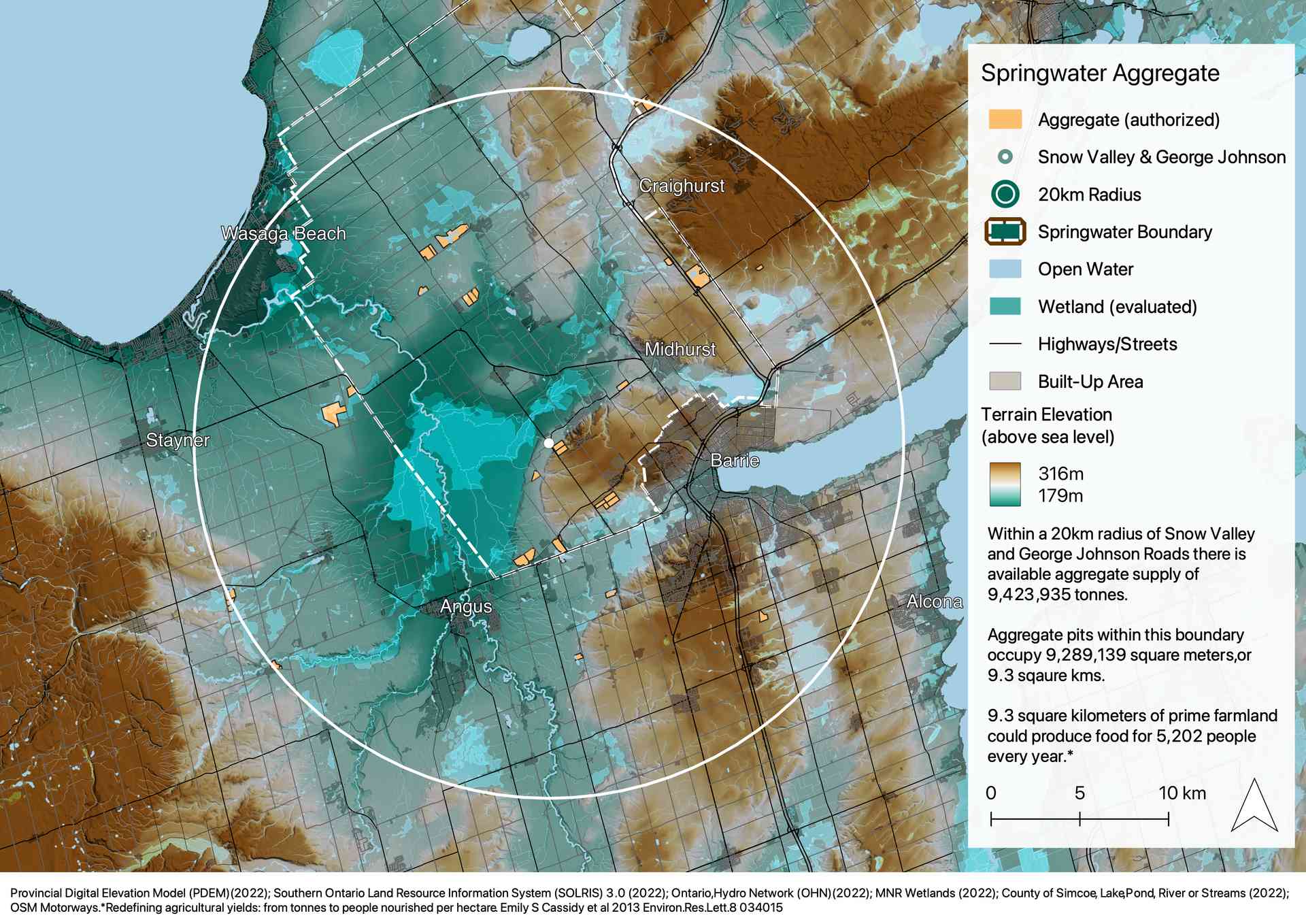
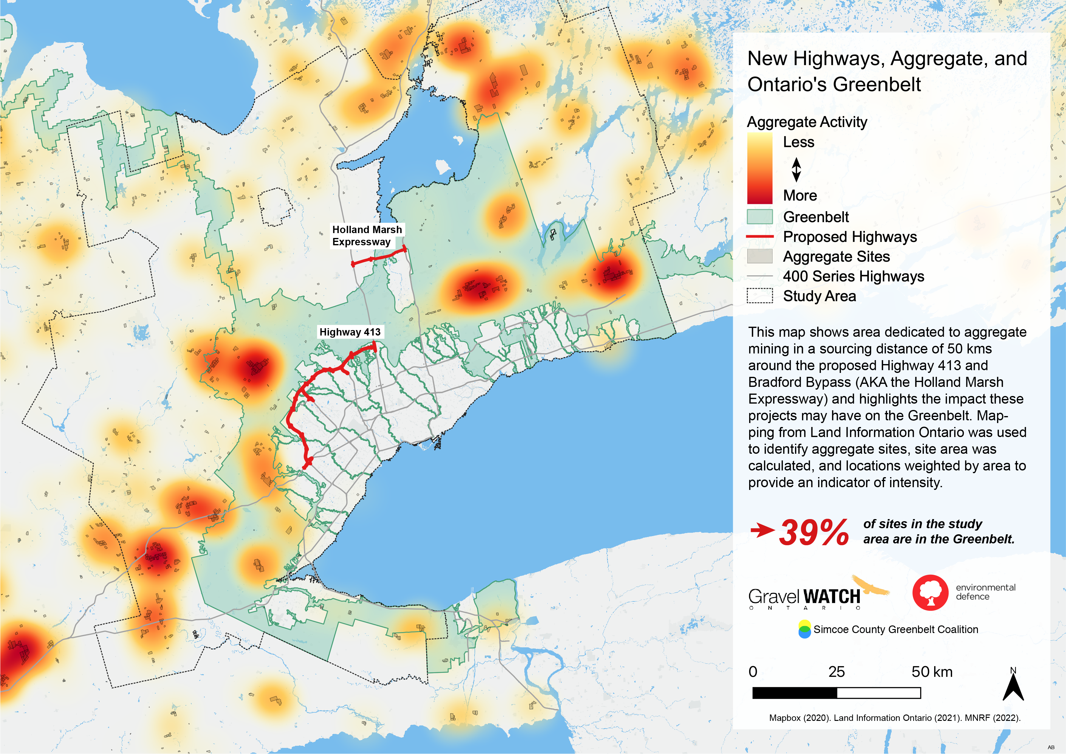
Aggregate
Mapping showing aggregate operations and possible impacts to water quality in Tay Township, Ontario.
Mapping showing a proposed development in Ramara. Council was seeking a MZO to proceed. Lake Couchiching is shallow and susceptible to impacts from development, and this simply isn’t the right place for it.
Become part of our network. Stay informed. Take action. Protect Ontario.
Friends. Online censorship by unaccountable tech companies, combined with an all-out assault on the Greenbelt by Ontario’s developers/government, make this a perilous time for the future of democracy and the power of the people in Ontario.
We need to build new ways of empowering those who believe in accountability, in a healthy environment, and in communities ready to thrive in the economy of tomorrow.
Join our supporter network and stay informed about efforts and actions to protect the Greenbelt, to build communities that support the health and well-being of people, and to lay the foundations of a resilient, climate friendly future.