Overview
In 2019 the Rescue Lake Simcoe Coalition undertook a study to determine how much land in Simcoe County had some level of protection.
Land-use policies, or regulations made by provincial and local governments that determine where cities and towns are built and how natural resources are used, have struggled to keep up with the demands of a changing climate.
Pressure on water, farmland, and natural areas for habitat and carbon sequestration are increasing, yet we see only incremental change in policies governing them.
This report set out to look at the state of lands protected in Simcoe County, and to determine whether more needs to be done.
Categories of Protection
The report identifies three levels of protection based on different polices they are covered by, and notes current and likely vulnerabilities or threats to natural areas, water, and farmland under existing policies.
Protected Lands Map
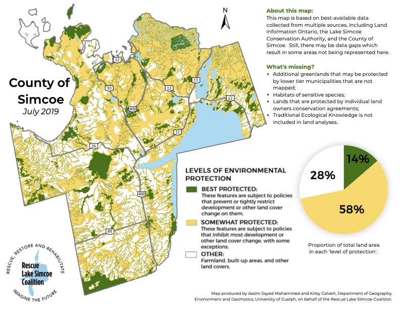
A map was produced that shows where the different levels of protected lands, as well as the proportion of lands under the different categories of protection.
As you can see a good portion of Best Protected greenland is covered by the Minesing Wetlands, located in the centre of the County just to the west of Kempenfelt Bay in Lake Simcoe.
The Minesing Wetlands are a designated under the Ramsar Convention as a wetland of international importance.
Click the image for a high resolution version.
Conclusion and Recommendations
Wetland Cover
Environment Canada recommends a minimum of 10% wetland cover in Southern Ontario.
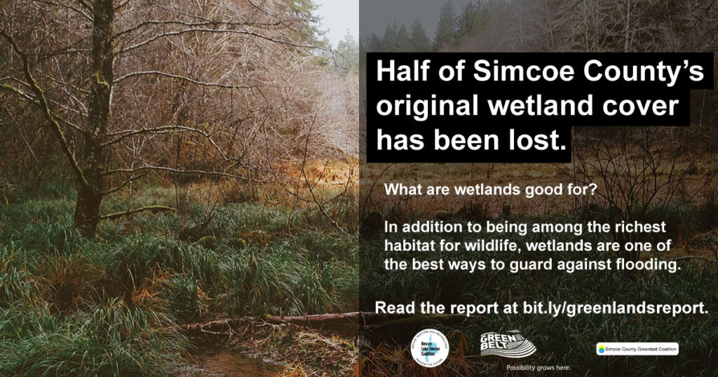
Simcoe County has 14% wetland cover based on this analysis, approximately half of which is historic or pre-settlement cover.
Despite the relatively good looking numbers, Simcoe County is losing wetlands.
Many subwatersheds are below the LSRCA’s watershed-wide targets. (Subwatersheds are areas that drain into a river that itself drains into the main receiving body of water, such as Lake Simcoe and Lake Huron.)
To achieve “no net loss”, all wetlands should be formally evaluated, identified and protected in the County’s Natural Heritage System.
Forest Cover
Having at least 50% forest cover equates to a “low-risk” approach, meaning that wildlife and ecosystems are highly likely to remain healthy and viable.
Simcoe County has only 22% forest cover based on this analysis.
Simcoe County is nowhere near the 50% forest cover target, and forest coverage continues to decline.
Forest cover is not evenly distributed across Simcoe County, with most cover in the north.
Ecologically based forest cover targets should be set for the subwatersheds
Impervious Land Cover
Impervious land, or land that does not allow for rainwater or other water to be easily absorbed, should be less than 10% of an urbanizing watershed. Impervious land cover increases costs of water management and risks of flooding.
Simcoe County is 8% urbanized. (Note that while not all land within an urban envelope is impervious, it is used as a rough proxy here in the absence of more detailed accounting.)
As new lands are zoned residential and developed the urbanized and impervious portion of the County will increase.
Efforts should be made to increase residential density within existing settlement boundaries to limit the need to convert more agricultural and natural lands to residential.
Initiatives like Barrie’s new Stormwater Climate Action Fund can be helpful in more accurately capturing the extra costs associated with impervious land cover.
Recommendations
We can achieve these ecological targets in Simcoe County, since we currently have 14% of the County in the Best Protected, and 58% in the Somewhat Protected categories.
But both of these categories allow for a death by a thousand cuts; many changes to land use are permitted even in the Best Protected category.
Provincial Actions
- Maintain or strengthen the provincial policies that protect wetlands, forests and shorelines in provincial planning documents;
- Make efforts to engage Indigenous people and ensure their perspectives and Traditional Ecological Knowledge are incorporated into provincial policies that protect wetlands, forests, shorelines and other significant natural features they may identify;
- Work with municipalities and the County to implement the Growth Plan’s Natural Heritage System for the Greater Golden Horseshoe and related policies as soon as possible to protect linkages in particular;
- Prohibit the removal of greenlands and linkages from the Growth Plan’s Provincial Natural Heritage System;
- Preliminary maps of “high quality natural cover” have been developed by the province in the Lake Simcoe watershed. Take the next steps and ensure the mapping is completed, and that these features are protected in the Lake Simcoe Protection Plan;
- Expand the Greenbelt into Simcoe County.
Municipal Actions
- Municipalities in the Lake Simcoe watershed that have not already done so, should adopt the Lake Simcoe Region Conservation Authority’s Natural Heritage Strategy in their municipal Official Plans;
- Municipalities in the Nottawasaga Valley watershed should implement the Natural Heritage recommendations in the NVCA’s Integrated Watershed Management Plan;
- Set targets, implementation mechanisms, and timelines to meet or exceed the federal habitat protection guidelines above, on a subwatershed basis, and put biodiversity objectives in municipal planning documents;
- Ensure that the “high quality natural cover” features in the Lake Simcoe watershed are protected in Simcoe County’s Official Plan;
- Refuse requests to expand settlement boundaries, and instead develop “complete communities”;
- Increase environmental restoration activity, focusing on linkages, shorelines and riverbanks;
- Develop strong regional and municipal tree cutting bylaws and enforcement regimes using the Ontario Woodlot Tree Conservation By-law Template;
- Explore and invest in green infrastructure.
Landowners
Landowners wanting to protect environmental or farm features on their lands forever can do so in a number of ways through a Land Trust.
Land Trusts are charitable organizations committed to permanent protection of lands with ecological, scenic, historical, agricultural and recreational values.
These Land Trusts operate in Simcoe County: Oak Ridges Moraine Land Trust, Couchiching Conservancy, Nature Conservancy of Canada, and Huronia Land Conservancy. See the Ontario Land Trust Alliance website for information about local land trusts.

Draw attention to this issue by sharing to social media.

